
Jeffrey City in Fremont County, Wyoming — The American West (Mountains)
Jeffrey City
Biggest Bust of Them All
Photographed by Duane Hall, May 28, 2013
1. Jeffrey City Marker
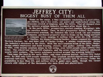
In the early 1950s, prospectors started combing Wyoming's hills for surefire riches. Then, in 1954 prospector Robert (Bob) Adams discovered uranium. He founded the Lost Creek Oil and Uranium Company, purchased property next to Home on the Range and built a company town, naming it Jeffrey City after Dr. C.W. Jeffrey of Rawlins, his biggest financial backer. Adams renamed his company Western Nuclear, Inc. and later sold to Phelps-Dodge, a mining conglomerate, during the industry's slowdown in the 1960s. With the next uranium boom in the 1970s, Phelps-Dodge added employees and built housing, streets, and parks; Jeffrey City bustled. In 1980, with nearby uranium mines in full swing, over 4,000 people called Jeffrey City home. The school had almost 600 students, and the area's uranium industry employed nearly 1,000 workers. The town's existence revolved around the uranium
this page online
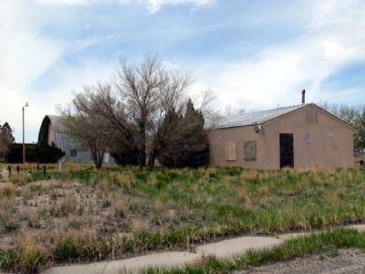
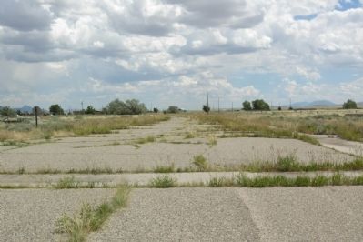
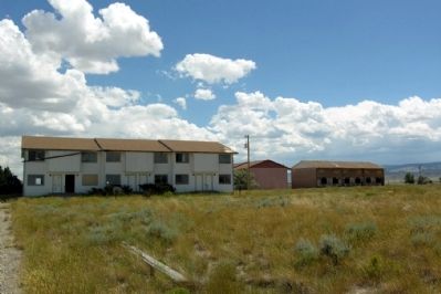
Then came the bust in the early 1980s - and when uranium busted, Jeffrey City faded away. By 1982 only 1,000 people remained. The uranium market dipped lower and nearly everyone left town. Homes were wheeled away, and families left in droves. Today the population is less than 100, and Jeffrey City is quiet once again, though the vacant streets still whisper of the thousands who once lived and played here.
Erected by Wyoming Historic Mine Trail and Byway System.
Topics. This historical marker is listed in these topic lists: Industry & Commerce • Natural Resources • Settlements & Settlers • War, Cold. A significant historical year for this entry is 1954.
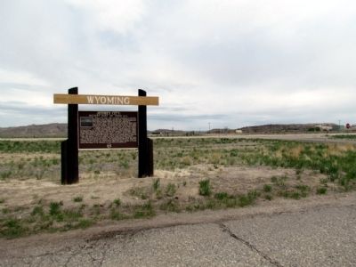
Location. 42° 29.711′ N, 107° 49.868′ W. Marker is in Jeffrey City, Wyoming, in Fremont County. It is at the intersection of Sweetwater Boulevard and Bob Adams Avenue, on the right when traveling west on Sweetwater Boulevard. Touch for map. Marker is in this post office area: Jeffrey City WY 82310, United States of America. Touch for directions.

Regionally, this marker is in Wind River Country. It is also in the American Mountain West. Globally,
Photographed by Duane Hall, May 28, 2013
2. Close-up of Image on Jeffrey City Marker
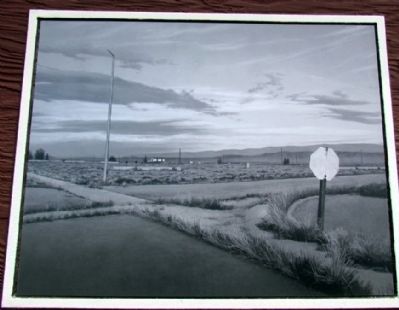
Caption: "STOP (Jeffrey City, WY)" painting by Travis Ivey, 2008. CAPA-2009.3.1, Department of State Parks and Cultural Resources, Wyoming State Museum
Other nearby markers. At least 2 other markers are within 10 miles of this marker, measured as the crow flies: Gold Flakes to Yellowcake Historic Mine Trail (a few steps from this marker); Ice Slough (approx. 9.2 miles away).
Photographed by Duane Hall, May 28, 2013
3. Jeffrey City Marker
Photographed by Duane Hall, May 28, 2013
4. View from Marker
Photographed by Duane Hall, July 31, 2010
5. Abandoned Street in Jeffrey City
Photographed by Duane Hall, July 31, 2010
6. Abandoned Apartment Buildings in Jeffrey City
Credits. This page was last revised on January 14, 2025. It was originally submitted on July 25, 2013, by Duane Hall of Abilene, Texas. This page has been viewed 1,911 times since then and 105 times this year. Photos: 1, 2, 3, 4, 5, 6. submitted on July 25, 2013, by Duane Hall of Abilene, Texas. • Syd Whittle was the editor who published this page.
