Penn Township near Jeannette in Westmoreland County, Pennsylvania — The American Northeast (Mid-Atlantic)
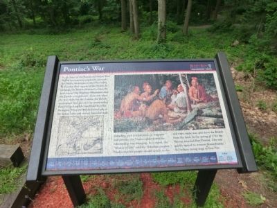
Pontiac's War
Bushy Run Battlefield
Photographed by Don Morfe, July 17, 2013
1. Pontiac's War Marker
(Time line at the bottom of the marker)
1763-May 9-Siege of Fort Detroit;
May 16-Fort Sandusky falls;
May 25-Fort St. Joseph falls;
May 27-Fort Miami falls;
May 29-Siege of Fort Pitt;
June 1-Fort Ouiatenon
this page online
June 2-Fort Michilimackinac falls;
June 2-Fort Ligonier attacked;
June 4-Fort Pitt’s help request reaches Col. Bouquet;
June 12-Amhearst orders the 42nd and 77th to Bouquet;
June 16-Fort Venango falls;
June 18-Fort Le Boeuf falls;
June 22-Fort Pesque Isle falls;
July 15-Bouquet leaves Carlisle;
July 25-Bouquet arrives at Fort Bedford;
August 2-Bouquet arrives at Fort Ligonier;
August 4-Bouquet leaves Fort Ligonier;
August 5-Natives attack Bouquet relief forces;
August 6-British defeat the Natives at Bushy Run;
August 10-British arrive at Fort Pitt.
Erected by Pennsylvania Historical and Museum Commission.
Topics. This memorial is listed in this topic list: War, French and Indian. A significant historical year for this entry is 1773.
Location. 40° 21.517′ N, 79° 37.517′ W. Memorial is near Jeannette, Pennsylvania, in Westmoreland County. It is in Penn Township. It can be reached from Bushy Run Road (Pennsylvania Route 993) 0.6 miles east of Gongaware Road, on the left when traveling east. The marker is located in the Bushy Run Battlefield Park. Touch for map. Memorial is at or near this postal address: 1253 Bushy Run Road,
Photographed by Don Morfe, July 17, 2013
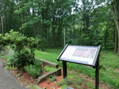
2. Pontiac's War Marker

Regionally, this memorial is in the Laurel Highlands and in Greater Pittsburgh. It is also in the American Northeast, in the Mid-Atlantic, in Appalachia, and specifically in Northern Appalachia. Globally, it is in North America, the Western Hemisphere, the Western World, and the Anglosphere. Historically, it finds itself in what was once the Viceroyalty of New France, the Haudenosaunee (Iroquois) Confederacy, and one of the original Thirteen Colonies.
Other nearby markers. At least 8 other markers are within walking distance of this marker: C. Martin Bomberger (within shouting distance of this marker); The Iroquois Nature Trail (within shouting distance of this marker); The Central Fire (within shouting distance of this marker); Andrew Byerly's Spring (within shouting distance of this marker); Welcome to Bushy Run Battlefield (about 500 feet away, measured in a direct line); Ambushed (approx. 0.2 miles away); After The Battle (approx. 0.2 miles away); Bushy Run Battlefield (approx. 0.2 miles away). Touch for a list and map of all markers in Jeannette.
Also see . . . Bushy Run Battlefield website.

Photographed by Bradley Owen, April 9, 2025
3. Marker at Ground Level
Jack E. Terrill
Dedicated volunteer for
Bushy Run Battlefield
1990 - 2005
Dedicated 2010
Credits. This page was last revised on May 2, 2025. It was originally submitted on August 7, 2013, by Don Morfe of Baltimore, Maryland. This page has been viewed 1,392 times since then and 37 times this year. Photos: 1, 2. submitted on August 7, 2013, by Don Morfe of Baltimore, Maryland. 3. submitted on April 26, 2025, by Bradley Owen of Morgantown, West Virginia. • Bill Pfingsten was the editor who published this page.
