Marker Logo HMdb.org THE HISTORICAL
MARKER DATABASE
“Bite-Size Bits of Local, National, and Global History”
Winnemucca in Humboldt County, Nevada — The American Mountains (Southwest)
 

Winnemucca to the Sea Highway


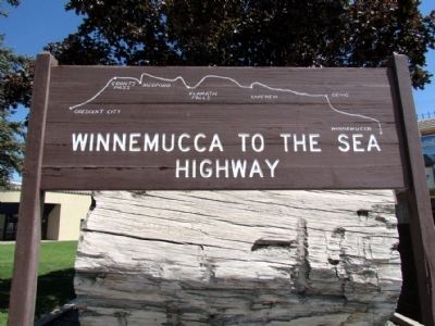
Winnemucca to the Sea Highway Marker image. Click for full size.
Photographed By Duane Hall, July 5, 2013
1. Winnemucca to the Sea Highway Marker
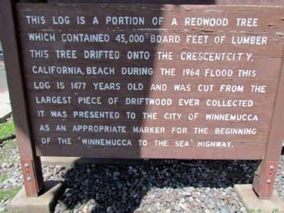
Inscription. This log is a portion of a redwood tree which contained 45,000 board feet of lumber. This tree drifted onto the Crescent City, California, beach during the 1964 flood. This log is 1477 years old and was cut from the largest piece of driftwood ever collected. It was presented to the City of Winnemucca as an appropriate marker for the beginning of the 'Winnemucca to the Sea' Highway.
 
Topics. This historical marker is listed in this topic list: Roads & Vehicles. A significant historical year for this entry is 1964.
 
Location. 40° 58.385′ N, 117° 44.141′ W. Marker is in Winnemucca, Nevada, in Humboldt County. Marker is at the intersection of Melarkey Street (U.S. 95) and W. Winnemucca Boulevard (Nevada Route 289), on the right when traveling north on Melarkey Street. Touch for map. Marker is in this post office area: Winnemucca NV 89445, United States of America. Touch for directions.
 
Other nearby markers. At least 8 other markers are within walking distance of this marker. California Trail - Trading Post (a few steps from this marker); Butch Cassidy's Wild Bunch Bank Robbery (about 500 feet away, measured in a direct line); Winneva Building (about 600 feet away); Humboldt Canal (about 700 feet away); Great Black Stone (about 700 feet away); Winnemucca World War I American Legion Honor Roll (about 800 feet away); Site of school house
Paid Advertisement
Click on the ad for more information.
Please report objectionable advertising to the Editor.
Click or scan to see
this page online
(approx. 0.2 miles away); Pioneer Memorial Park (approx. half a mile away). Touch for a list and map of all markers in Winnemucca.
 
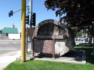
Winnemucca to the Sea Highway Marker image. Click for full size.
Photographed By Duane Hall, July 5, 2013
2. Winnemucca to the Sea Highway Marker
Winnemucca to the Sea Highway Marker image. Click for full size.
Photographed By Duane Hall, July 5, 2013
3. Winnemucca to the Sea Highway Marker
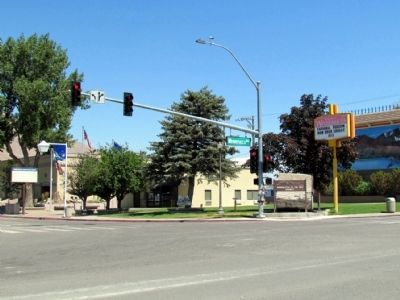
Melarkey Street and W. Winnemucca Blvd Intersection image. Click for full size.
Photographed By Duane Hall, July 5, 2013
4. Melarkey Street and W. Winnemucca Blvd Intersection
 
 
Credits. This page was last revised on October 27, 2020. It was originally submitted on August 7, 2013, by Duane Hall of Abilene, Texas. This page has been viewed 1,084 times since then and 68 times this year. Photos:   1, 2, 3, 4. submitted on August 7, 2013, by Duane Hall of Abilene, Texas.
Share this page.  
Share on Tumblr
m=67388

CeraNet Cloud Computing sponsors the Historical Marker Database.
This website earns income from purchases you make after using our links to Amazon.com. We appreciate your support.
Paid Advertisement
Apr. 23, 2024