Near Pleasanton in Linn County, Kansas — The American Midwest (Upper Plains)
The Battle Begins
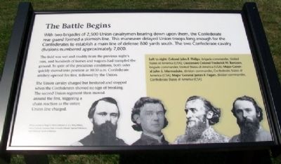
With two brigades of 2,500 Union cavalrymen bearing down upon them, the Confederate rear guard formed a skirmish line. This maneuver delayed Union troops long enough for the Confederates to establish a main line of defense 800 yards south. The two Confederate cavalry divisions numbered approximately 7,000.
The field was wet and muddy from the previous night's rain, and hundreds of horses and wagons had trampled the ground. In spite of the precarious conditions, both sides quickly moved into position at 10:30 a.m. Confederate artillery opened fire first, followed by the Union.
The Union cavalry charged but hesitated and stopped when the Confederates showed no sign of breaking. The second Union regiment then moved around the first, triggering a chain reaction as the entire Union line charged.
[Inset photo caption reads]
Left to right: Colonel John F. Philips, brigade commander, United States of America (USA); Lieutenant Colonel Frederick W. Benteen, brigade commander, United States of America; Major General John S. Marmaduke, division commander, Confederate States of America (CSA); Major General James F. Fagan, division commander, Confederate States of America (CSA)
Photos courtesy of Roger D. Hunt Collection at U.S. Army Military History Institute; Louisiana State University Libraries' Special Collections; State Historical Society of Missouri
Erected 2012 by Kansas State Historical Society.
Topics. This historical marker is listed in this topic list: War, US Civil.
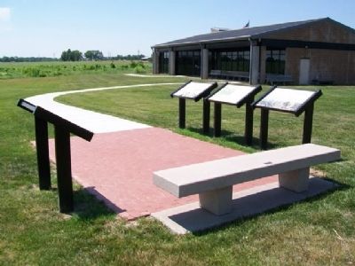
Location. 38° 8.687′ N, 94° 43.393′ W. Marker is near Pleasanton, Kansas, in Linn County. Marker is southeast of the visitor center. Touch for map. Marker is at or near this postal address: 20485 Kansas Highway 52, Pleasanton KS 66075, United States of America. Touch for directions.
Other nearby markers. At least 8 other markers are within walking distance of this marker. Confederate Defeat (here, next to this marker); After the Battle (here, next to this marker); The Fort Scott Road (a few steps from this marker); Two Mounted Armies Collide (a few steps from this marker); Battle of Mine Creek (within shouting distance of this marker); Mine Creek Battlefield Aerial Overlay (within shouting distance of this marker); Combat at State Line (within shouting distance of this marker); Price's Raid (within shouting distance of this marker). Touch for a list and map of all markers in Pleasanton.
Also see . . .
1. Battle of Mine Creek, Kansas. (Submitted on August 8, 2013, by William Fischer, Jr. of Scranton, Pennsylvania.)
2. Mine Creek Battlefield State Historic Site, Kansas. (Submitted on August 8, 2013, by William Fischer, Jr. of Scranton, Pennsylvania.)
Credits. This page was last revised on September 6, 2020. It was originally submitted on August 8, 2013, by William Fischer, Jr. of Scranton, Pennsylvania. This page has been viewed 471 times since then and 11 times this year. Photos: 1, 2. submitted on August 8, 2013, by William Fischer, Jr. of Scranton, Pennsylvania.

