South of Broad in Charleston in Charleston County, South Carolina — The American South (South Atlantic)
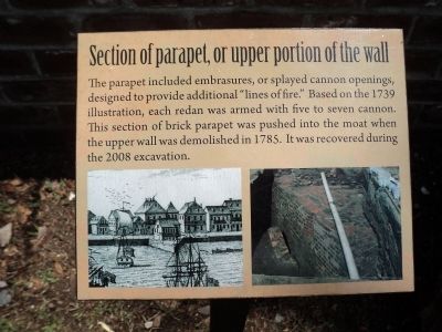
Section of parapet, or upper portion of the wall
Inscription.
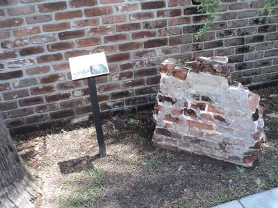
The parapet included embrasures, or splayed cannon openings, designed to provide additional “lines of fire.” Based on the 1739 illustration, each redan was armed with five to seven cannon. This section of brick parapet was pushed into the moat when the upper wall was demolished in 1785. It was recovered during the 2008 excavation.
Topics. This historical marker is listed in this topic list: Colonial Era. A significant historical year for this entry is 1739.
Location. 32° 46.415′ N, 79° 55.634′ W. Marker is in Charleston, South Carolina, in Charleston County. It is in South of Broad. Marker is on E Bay Street, on the right when traveling north. Touch for map. Marker is in this post office area: Charleston SC 29401, United States of America. Touch for directions.
Other nearby markers. At least 8 other markers are within walking distance of this marker. The Walled City of Charles Town (here, next to this marker); In Search of the Walled City (here, next to this marker); Casper Christian Schutt House (within shouting distance of this marker); The Site of Granville Bastion (within shouting distance of this marker); The Seizure of the Planter (within shouting distance of this marker); Thomas Smith (about 400 feet away, measured in a direct line); 6 Water Street - Francis Saltus House (about 400 feet away); James Verree House (about 500 feet away). Touch for a list and map of all markers in Charleston.
More about this marker. The bottom of the marker contains a picture showing a redan at 18th century Charleston. Next to this is a photograph of an archeological dig when this wall was located.
Credits. This page was last revised on February 16, 2023. It was originally submitted on August 8, 2013, by Bill Coughlin of Woodland Park, New Jersey. This page has been viewed 557 times since then and 29 times this year. Photos: 1, 2, 3, 4. submitted on August 8, 2013, by Bill Coughlin of Woodland Park, New Jersey.


