Youngstown in Niagara County, New York — The American Northeast (Mid-Atlantic)
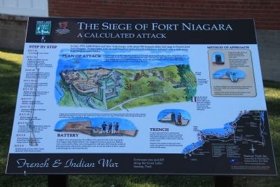
The Siege of Fort Niagara
A Calculated Attack
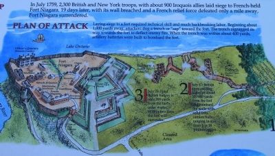
Plan of Attack
Laying siege to a fort required technical skill and much backbreaking labor. Beginning about 1,000 yards away, attackers dug a trench or "sap" toward the fort. The trench zigzagged its way towards the fort to deflect enemy fire. When the trench was within about 400 yards, artillery batteries were built to bombard the fort.
1. July 10: British open trenches about 1,000 yards from Fort Niagara. The French inside the fort can see fresh dirt at about 640 yards.
2. July 17: British open artillery batteries about 300-400 yards from the fort and bombard the walls with solid iron cannon balls ranging in size from 6 to 18 pounds apiece.
3. July 23: Final British battery is only 100 yards from the fort's outer works. Within two days the fort will surrender.
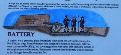
A siege was an orderly process bound by procedures that were perfected in Europe during the 17th and early 18th centuries. Although Fort Niagara lay deep in the wilderness of North America, the siege of 1759 closely followed siege techniques and conventions that were standard in Europe.
Trench
To safely approach the fort, attackers built trenches and earthworks reinforced by gabions (twig baskets designed to be filled with earth) and fascines (bundles of sticks used to shore up earthen walls).
Engineers first marked out the route of the trench, then gabions were placed between the trench and the enemy.
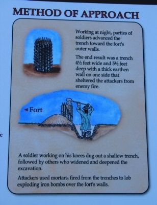
Method of Approach
Working at night, parties of soldiers advanced the trench toward the fort's outer walls.
The end result was a trench 4½ feet wide and 5½feet deep with a thick earthen wall on one side that sheltered the attackers from enemy fire.
A soldier working on his knees dug out a shallow trench, followed by others who widened and deepened the excavation.
Attackers used mortars, fired from the trenches to lob exploding iron bombs over the forts walls.
Battery
A battery was a protected place for artillery to fire upon the fort's walls. During the Fort Niagara siege, British batteries were designed to house six guns each. Batteries were constructed by filling and covering gabions with earth, then lining the outside of the emplacement with fascines. Embrasures were cut into the battery to allow cannons to fire through the wall toward
the fort.
Step By Step
July 6
British land at Four Mile Creek, skirmish with French scouts.
July 8
Main British Army marches from Four Mile Creek to camp east of Fort Niagara.
July 9
Captain Walter Rutherford delivers a surrender demand, the French commander, Captain Pierre Pouchot politely refuses.
July 10
British begin to dig their trench toward fort.
July 12
American Indians withdraw from Siege.
July 17
British complete first battery, open fire on fort.
July 20
British General John Prideaux killed, Sir William Johnson assumes command.
July 22-23
French guns are repeatedly being put out of action and then remounted.
July 23
A new British battery opens only 100 yards from the fort. Word reaches the fort that a French relief party is near.
July 24
Battle of La belle Famille fought just one mile south of Fort Niagara. French relief party is defeated, sealing the fate of Fort Niagara.
July 25
Fort Niagara surrenders
Erected by Seaway Trail,
Inc.
Topics and series. This historical marker is listed in these topic lists: Forts and Castles • Native Americans • War, French and Indian. In addition, it is included in the Great Lakes Seaway Trail National Scenic Byway series list. A significant historical month for this entry is July 1759.
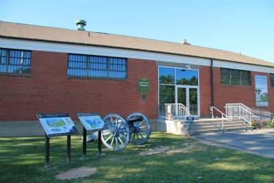
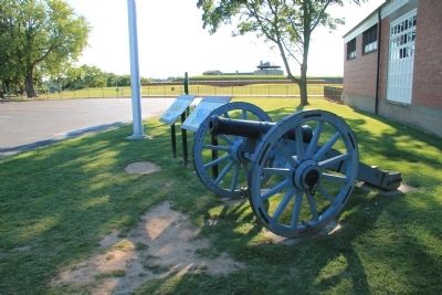
Location. 43° 15.747′ N, 79° 3.632′ W. Marker is in Youngstown, New York, in Niagara County. Marker is on Scott Avenue north of Jackson Street (Route 18F), on the right when traveling north. This historical marker is located a short drive north of the downtown Youngstown area, in the Fort Niagara State Park. According to Google Map it is located at the end of the Scott Avenue loop, next to the front entrance to the Visitor Center & Museum for Old Fort Niagara. Touch for map. Marker is in this post office area: Youngstown NY 14174, United States of America. Touch for directions.
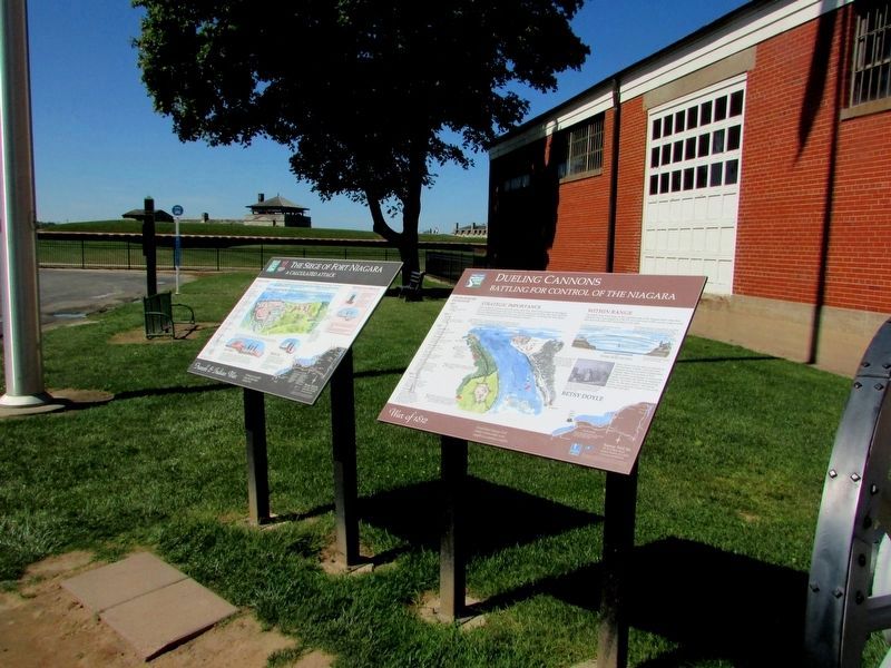
Other nearby markers. At least 8 other markers are within walking distance of this marker. Dueling Cannons (here, next to this marker); Old Fort Niagara Cannon (here, next to this marker); Old Fort Niagara (a few steps from this marker); Morrow Plaza (a few steps from this marker); The Niagara Portage: Gateway to the West (within shouting distance of this marker); a different marker also named Old Fort Niagara (within shouting distance of
this marker); Old Fort Niagara Lighthouse (within shouting distance of this marker); To the Memory (about 400 feet away, measured in a direct line). Touch for a list and map of all markers in Youngstown.
Also see . . .
1. Battle of Fort Niagara. This is a link to information provided by Wikipedia, the free encyclopedia. (Submitted on August 9, 2013, by Dale K. Benington of Toledo, Ohio.)
2. French & Indian War: Battle of Fort Niagara. This is a link to information provided by the About.com website. (Submitted on August 9, 2013, by Dale K. Benington of Toledo, Ohio.)
Credits. This page was last revised on September 24, 2019. It was originally submitted on August 9, 2013, by Dale K. Benington of Toledo, Ohio. This page has been viewed 1,088 times since then and 46 times this year. Photos: 1. submitted on August 9, 2013, by Dale K. Benington of Toledo, Ohio. 2. submitted on September 23, 2019, by Bill Coughlin of Woodland Park, New Jersey. 3, 4. submitted on August 9, 2013, by Dale K. Benington of Toledo, Ohio. 5. submitted on August 10, 2013, by Dale K. Benington of Toledo, Ohio. 6. submitted on August 9, 2013, by Dale K. Benington of Toledo, Ohio. 7, 8. submitted on August 10, 2013, by Dale K. Benington of Toledo, Ohio.
