Near West Wendover in Elko County, Nevada — The American Mountains (Southwest)
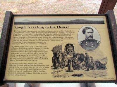
Tough Traveling in the Desert
Photographed by Duane Hall, July 5, 2013
1. Tough Traveling in the Desert Marker
In 1846 the Reed-Donner Party crossed this valley, following the Hastings Cutoff to the main California Trail. Crossing the salt flats just east of here was extremely difficult. Stock animals perished, wagons broke down, and the emigrants barely reached the life-saving springs at the base of Pilot Peak. This "short cut" slowed their progress and helped to set the stage for the disaster that lay 400 miles ahead of them in the
this page online
As travelers today along Interstate 80, you're following the same route as these early explorers and emigrants. On a good day, they worked hard to cover 10 to 15 miles through this harsh landscape. In the comfort of your air conditioned vehicle, you can cover in 10 minutes the distance it took these earlier travelers all day to cover!
Topics. This historical marker is listed in these topic lists: Exploration • Roads & Vehicles • Settlements & Settlers. A significant historical year for this entry is 1841.
Location. 40° 50.71′ N, 114° 12.49′ W. Marker is near West Wendover, Nevada, in Elko County. It can be reached from Pilot Road 0.2 miles north of Interstate 80, on the right when traveling north. Pilot Road is accessed from Exit 398 of I-80. Touch for map. Marker is in this post office area: West Wendover NV 89883, United States of America. Touch for directions.

Regionally, this marker is in Elko Country. It is also in the American Mountain West. Globally, it is in North America, the Western Hemisphere, the Western World, and the Anglosphere. Historically, it finds itself in what was once
Photographed by Duane Hall, July 5, 2013
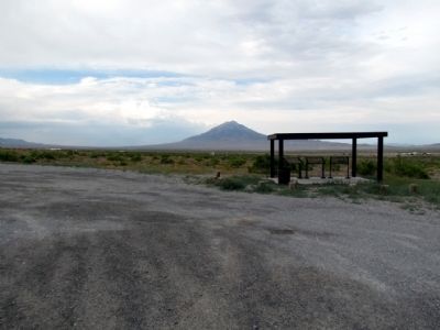
2. Where Did the Lake Go?,
Can Anything Survive Here?, and
Tough Traveling in the Desert Markers
Can Anything Survive Here?, and
Tough Traveling in the Desert Markers
Other nearby markers. At least 8 other markers are within 11 miles of this marker, measured as the crow flies: Can Anything Survive Here? (here, next to this marker); Where Did the Lake Go? (here, next to this marker); Pilot Peak (about 500 feet away, measured in a direct line); Transcontinental Telephone Line (approx. 10.1 miles away); Ancient Lake Bonneville (approx. 10.1 miles away); Historic Wendover Field (approx. 10.1 miles away); Western Pacific Railroad (approx. 10.1 miles away); Lincoln Highway (approx. 10.1 miles away). Touch for a list and map of all markers in West Wendover.
Photographed by Duane Hall, July 5, 2013
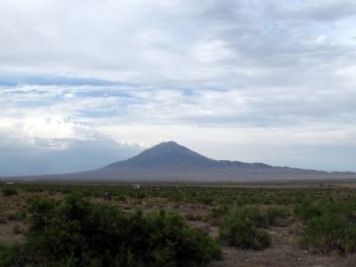
3. Pilot Peak
Credits. This page was last revised on June 16, 2016. It was originally submitted on August 11, 2013, by Duane Hall of Abilene, Texas. This page has been viewed 708 times since then and 34 times this year. Photos: 1, 2, 3. submitted on August 11, 2013, by Duane Hall of Abilene, Texas.
