Homosassa Springs in Citrus County, Florida — The American South (South Atlantic)
Florida Boom Sidewalk
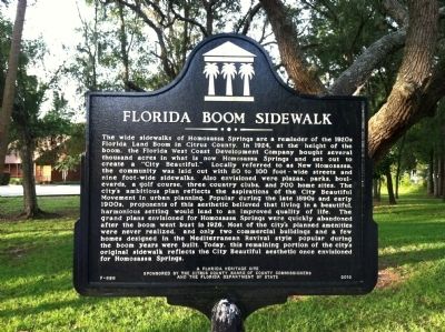
Photographed by Tim Fillmon, August 2, 2013
1. Florida Boom Sidewalk Marker
this page online
Erected 2010 by The Citrus Board of County Commissioners and the Florida Department of State. (Marker Number F-696.)
Topics. This historical marker is listed in these topic lists: Architecture • Roads & Vehicles • Settlements & Settlers. A significant historical year for this entry is 1924.
Location. 28° 48.29′ N, 82° 34.508′ W. Marker is in Homosassa Springs, Florida, in Citrus County. It is at the intersection of West Aquaduct Street and South Pittsburgh Avenue, on the left when traveling east on West Aquaduct Street. Touch for map. Marker is in this post office area: Homosassa FL 34448, United States of America. Touch for directions.

Regionally, this marker is on Florida’s Gulf Coast. It is also in the American South and on the Gulf Coast. Globally, it is in the North Atlantic Region, North America, a Gulf of Mexico state, the Western Hemisphere, the Western World, and the Anglosphere. Historically, it finds itself in what was once New Spain, the territory of the Mississippian Culture, one of the Confederate
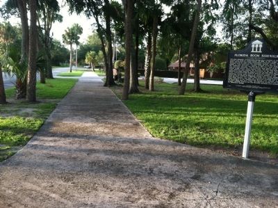
Photographed by Tim Fillmon, August 2, 2013
2. Florida Boom Sidewalk
Other nearby markers. At least 8 other markers are within 7 miles of this marker, measured as the crow flies: Stage Stand Cemetery (approx. 0.6 miles away); David Levy Yulee (approx. 2.4 miles away); Removing the Juice from the Cane (approx. 2.4 miles away); Steam Engine and Gears (approx. 2.4 miles away); Kettles and Operation (approx. 2.4 miles away); Old Homosassa Veterans Memorial (approx. 2.9 miles away); Bicentennial Park War Memorial (approx. 4.6 miles away); Michigan Town (approx. 6½ miles away).
Credits. This page was last revised on August 18, 2020. It was originally submitted on August 12, 2013, by Tim Fillmon of Webster, Florida. This page has been viewed 1,513 times since then and 55 times this year. Photos: 1, 2. submitted on August 12, 2013, by Tim Fillmon of Webster, Florida. • Bernard Fisher was the editor who published this page.
