Near Coalville in Summit County, Utah — The American Mountains (Southwest)
Echo Canyon
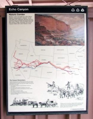
Historic Corridor
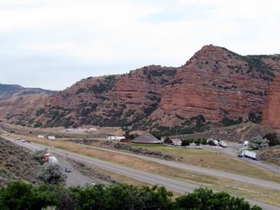
Modern roads and highways often follow historic transportation corridors. In the mid 1800s, the California, Mormon Pioneer, and Pony Express Trails all passed through this canyon. Today, Interstate 80 in Echo Canyon follows the same historic route.
The Canyon Remembers
Sounds of travelers have lingered between these red canyon walls for hundreds of years. Sometimes, if you listen closely, through the din of today's auto and truck traffic you may hear the echoes of our past:
• the scraping of native Ute and Shoshone travois on river gravel,
• the crunch of fur trapper's footsteps in the snow,
• the whinnying, braying, and bellowing of horses, mules, and oxen,
• the crack of a teamster's whip,
• the creaking of wagons and stagecoaches,
• and the chugging, hissing, and clickity-clack of a steam locomotive on rails.
(Drawing Caption)
Walking next to an ox-drawn wagon in 1847. It took two days to get here from the Wyoming border. By Overland Stage in 1859, the trip took over three hours. By train in 1870, the distance was covered in just under two hours. How long did it take you today?
Erected by Utah Department of Transportation and Utah Historic Trails Consortium.
Topics and series. This historical marker is listed in this topic list: Roads & Vehicles. In addition, it is included in the California Trail, the Mormon Pioneer Trail, and the Pony Express National Historic Trail series lists. A significant historical year for this entry is 1847.
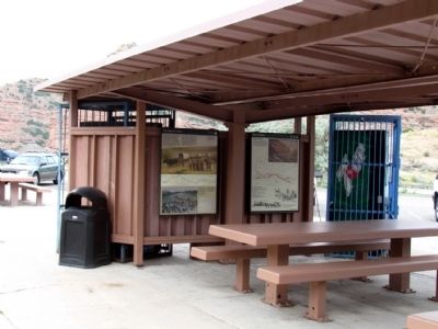
Location. 40° 59.385′ N, 111° 24.161′ W. Marker is near Coalville, Utah, in Summit County. Marker can be reached from Interstate 80 at milepost 171, on the right when traveling east. Marker is located at the Echo Canyon East Rest Area approx. two miles east of I-84 / I-80 Junction and I-80 Exit 169. Marker can only be accessed from the eastbound lanes of the freeway. Touch for map. Marker is in this post office area: Coalville UT 84017, United States of America. Touch for directions.
Other nearby markers. At least 7 other markers are within 12 miles of this marker, measured as the crow flies. The Road to Zion (here, next to this marker); Welcome to Echo Canyon (approx. 0.2 miles away); The Founding of Coalville City (approx. 5.1 miles away); Old Rock School House (approx. 5.2 miles away); "Mormon" Pioneer Trail (approx. 5.4 miles away); Old Fort and Hoyt Grist Mill (approx. 8.1 miles away); Wanship Station (approx. 11.9 miles away).
Credits. This page was last revised on June 16, 2016. It was originally submitted on August 13, 2013, by Duane Hall of Abilene, Texas. This page has been viewed 1,159 times since then and 45 times this year. Photos: 1, 2, 3. submitted on August 13, 2013, by Duane Hall of Abilene, Texas.


