Falmouth in Pendleton County, Kentucky — The American South (East South Central)
The Kennett Tavern
National Register of Historical Places
| — | Historical tavern and stagecoach stop (circa 1800) | — |
Photographed by Don Morfe, July 20, 2013
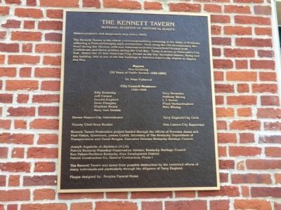
1. The Kennett Tavern Marker
Mayors Max Goldberg (50 Years of Public Service 1949-1998)
Dr. Peter Fullwood
City Council Members 1990-1998
Billy Browning, Jeff Carson, Donald England, Gene Flaughter, Virgilene Moore, Mary Ann Shields, Gary Showalter, Anthony Strong, L.T. Varner, Floyd Vanlandingham, Mike Whaley.
Steven Hasson-City Administer
Terry England-City Clerk
Deputy Clerk-Llean Koettel
Pete Lawson-City Supervisor.
Kennett Tavern Restoration project funded through the efforts of Brereton Jones and Paul Patton, Governor; James Codell, Secretary of the Kentucky Department of Transportation and David Morgan, Executive
this page online
Joseph Argabrite Jr.-Architect (A.I.A.); Patrick Kennedy-Historical Preservation Advisor, Kentucky Heritage Council; Ken Pallsin-Northern Kentucky Area Development District; Patriot Construction Co. General Contractors, Phase I.
The Kennett Tavern was saved from possible destruction by the combined efforts of many individuals- and particularly through the diligence of Terry England.
Plaque designed by: Peoples Funeral Home
Topics and series. This historical marker is listed in these topic lists: Industry & Commerce • Settlements & Settlers • War, US Civil • War, US Revolutionary. In addition, it is included in the Former U.S. Presidents: #03 Thomas Jefferson series list. A significant historical year for this entry is 1800.
Location. 38° 40.616′ N, 84° 19.799′ W. Marker is in Falmouth, Kentucky, in Pendleton County. It is on Main Street north of Shelby Street, on the right when traveling north. Touch for map. Marker is in this post office area: Falmouth KY 41040, United States of America. Touch for directions.

Regionally, this marker is in the Outer Bluegrass. It is also in
Photographed by Don Morfe, July 20, 2013
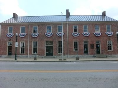
2. The Kennett Tavern Marker
Other nearby markers. At least 8 other markers are within 11 miles of this marker, measured as the crow flies: Virgilene Ritter Moore • Walter B. Moore (within shouting distance of this marker); Bell (within shouting distance of this marker); County Named 1798 (within shouting distance of this marker); Bird’s War Road (about 400 feet away, measured in a direct line); Albert A. Jameson (about 800 feet away); John Waller (approx. 4.1 miles away); British Indian Raid (approx. 6.1 miles away); Bold House (approx. 10.6 miles away). Touch for a list and map of all markers in Falmouth.
Credits. This page was last revised on November 10, 2024. It was originally submitted on August 14, 2013, by Don Morfe of Baltimore, Maryland. This page has been viewed 1,741 times since then and 95 times this year. Photos: 1, 2. submitted on August 14, 2013, by Don Morfe of Baltimore, Maryland. • Al Wolf was the editor who published this page.
