Millinocket in Penobscot County, Maine — The American Northeast (New England)
Mount Katahdin
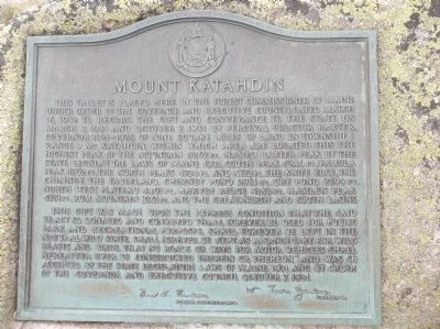
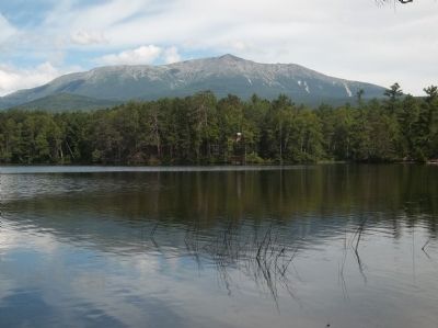
This tablet is placed here by the Forest Commissioner of Maine under order of the governor and Executive Council dated March 16, 1932 to record the gift and conveyance to the state on March 3, 1931 and October 7, 1931 by Percival Proctor Baxter, governor 1921-1925, of nine square miles of land in township 3 range 9 Mt. Katahdin, within which area are located this the highest peak of the mountain 5267 ft., named Baxter Peak by the state legislature laws of Maine 1931, South Peak 5240 ft., Pamola Peak 4902 ft., the North Peaks 4734 ft. and 4612 ft., the Knife Edge, the Chimney, the Tableland, Chimney Pond 2914 ft., Dry Pond 2799 ft., North West Plateau 4401 ft., Harvey Ridge 4182 ft., Hamlin Peak 4751 ft., Rum Mountain 3361 ft. and the Great, North and South Basins.
This gift was made upon the express condition that the said tract so donated and conveyed shall forever be used for public park and recreational purposes, shall forever be left in the natural wild state, shall forever be kept as a sanctuary for wild beasts and birds, that no roads or ways for motor vehicles shall hereafter ever be constructed therein or thereon,” and was so accepted by the state legislature laws of Maine 1931 and by Order of the Governor and Executive Council October 7, 1931.
Nick Violetti William Tudor Gardiner
Forest Commissioner Governor
Topics. This historical marker is listed in this topic list: Natural Features. A significant historical date for this entry is March 16, 1932.
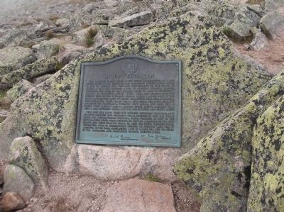
Location. 45° 54.27′ N, 68° 55.294′ W. Marker is in Millinocket, Maine, in Penobscot County. Marker can be reached from Baxter Park Road (Maine Route 157), on the right when traveling north. Marker is located in Baxter State Park, at the summit of Mount Katahdin (Baxter Peak). Touch for map. Marker is in this post office area: Millinocket ME 04462, United States of America. Touch for directions.
Other nearby markers. At least 5 other markers are within 13 miles of this marker, measured as the crow flies. Katahdin (here, next to this marker); Baxter State Park (approx. 3.3 miles away); Want to see a moose? Think like one! (approx. 12.7 miles away); The Golden Road (approx. 12.7 miles away); Destination Katahdin! (approx. 12.7 miles away).
More about this marker. The seal of the State of Main appears at the top of the marker.
Credits. This page was last revised on June 16, 2016. It was originally submitted on August 15, 2013, by Bill Coughlin of Woodland Park, New Jersey. This page has been viewed 504 times since then and 9 times this year. Photos: 1, 2, 3. submitted on August 15, 2013, by Bill Coughlin of Woodland Park, New Jersey.


