Tybee Island in Chatham County, Georgia — The American South (South Atlantic)
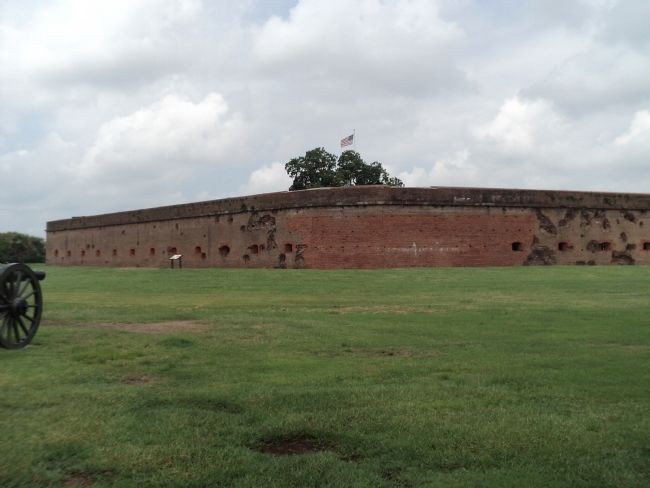
The Breached Wall
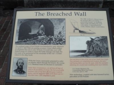
The southeast angle of Fort Pulaski was breached by early afternoon on April 11, 1862. With devastating accuracy, Union rifled artillery accomplished this task in only 30 hours. It would take over 1,000 Federal troops six weeks to repair the battle damage and make the fort ready to be garrisoned for the remainder of the war – a Union outpost in the deep South.
While the Union commander prepared to order an infantry attack through the breach, the young Col. Olmstead made his decision to surrender:
Under these circumstances, cut off from all hope of relief or the possibility of retreat, the Fort practicably breached, some of my most effective guns rendered useless, and the magazine liable to be blown up in a very short time, I felt compelled to yield.
You can form no idea of the ruin of our South East Angle. Two casemates are completely torn to pieces, the outer wall having fallen out into the moat, while the casemates adjoining are cracked and crumbling from top to bottom.
Col. Charles Olmstead, CSA
Commanding Officer, Fort Pulaski
to his wife, April 11, 1862
New technology, coupled with time-honored tactics, prevailed at Fort Pulaski.
Erected by National Park Service.
Topics. This historical marker is listed in these topic lists: Forts and Castles • War, US Civil. A significant historical month for this entry is April 1872.
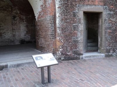
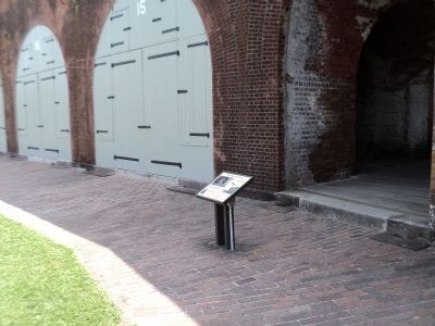
Location. Marker has been reported missing. It was located near 32° 1.595′ N, 80° 53.409′ W. Marker was on Tybee Island, Georgia, in Chatham County. Marker could be reached from Fort Pulaski Road, on the right when traveling north. Marker is located inside Fort Pulaski. Touch for map. Marker was in this post office area: Tybee Island GA 31328, United States of America. Touch for directions.
Other nearby markers. At least 8 other markers are within walking distance of this location. Through the Thick Brick Wall (a few steps from this marker); Federal Siege Batteries (a few steps from this marker); A Devastating Bombardment (a few steps from this marker); Fort at Play (within shouting distance of this marker); Store House (within shouting distance of this marker); Southwest Bastion (within shouting distance of this marker); Southwest Magazine (within shouting distance of this marker); 5,275 Shots & Shells in 30 Hours (within shouting distance of this marker). Touch for a list and map of all markers in Tybee Island.
More about this marker. Photographs of a ruined Fort Pulaski and Union artillery appear on the marker, along with a drawing of artillery firing on a fort. The illustration has a caption of “The 1860 Artillerist’s Manual shows the desired effect of creating ‘a practicable breach’ by breaking down walls and filling the moat with debris. A determined but costly infantry attack would follow.”
Also see . . . Fort Pulaski National Monument. National Park Service website. (Submitted on August 17, 2013, by Bill Coughlin of Woodland Park, New Jersey.)
Credits. This page was last revised on May 23, 2019. It was originally submitted on August 17, 2013, by Bill Coughlin of Woodland Park, New Jersey. This page has been viewed 468 times since then and 7 times this year. Photos: 1, 2, 3, 4, 5. submitted on August 17, 2013, by Bill Coughlin of Woodland Park, New Jersey.
