Garryowen in Big Horn County, Montana — The American West (Mountains)
Garryowen
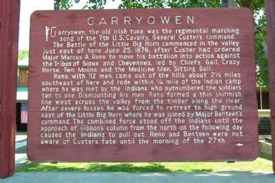
Garryowen, the old Irish tune, was the regimental marching song of the 7th U.S. Cavalry, General Custer's command.
The Battle of the Little Big Horn commenced in the valley just east of here June 25, 1876, after Custer had ordered Major Marcus A. Reno to move his battalion into action against the Tribes of Sioux and Cheyennes, led by Chiefs Gall, Crazy Horse, Two Moons and the Medicine Man, Sitting Bull.
Reno, with 112 men, came out of the hills about 2½ miles southeast of here and rode within ¼ mile of the Indian camp where he was met by the Indians who outnumbered the soldiers ten to one. Dismounting his men Reno formed a think skirmish line west across the valley from the timber along the river. After severe losses he was forced to retreat to high ground east of the Little Big Horn where he was joined by Major Benteen's command. The combined forces stood off the Indians until the approach of Gibbon's column from the north on the following day caused the Indians to pull out. Reno and Benteen were not aware of Custers fate until the morning of the 27th.
Topics. This historical marker is listed in this topic list: Wars, US Indian. A significant historical date for this entry is June 25, 1876.
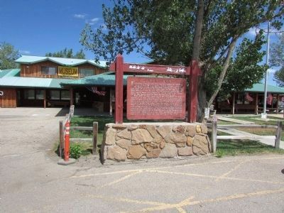
Location. 45° 31.595′ N, 107° 25.022′ W. Marker is in Garryowen, Montana , in Big Horn County. Marker is on Garryowen Road, on the right when traveling south. Marker is located on the east side of Garryowen Road one-quarter mile south of I-90 Exit 514. Touch for map. Marker is in this post office area: Garryowen MT 59031, United States of America. Touch for directions.
Other nearby markers. At least 8 other markers are within 2 miles of this marker, measured as the crow flies. Tomb of the Unknown Soldier (here, next to this marker); Garryowen, Montana - Sitting Bull’s Camp (a few steps from this marker); Weir Point (approx. 1.3 miles away); Weir Point Fight (approx. 1.3 miles away); Custer Last Seen (approx. 1.3 miles away); Sharpshooter Ridge (approx. 1.3 miles away); Medicine Tail Coulee (approx. 1.4 miles away); Medicine Tail Coulee Ford (approx. 1½ miles away). Touch for a list and map of all markers in Garryowen.
Credits. This page was last revised on June 16, 2016. It was originally submitted on August 19, 2013, by Duane Hall of Abilene, Texas. This page has been viewed 1,220 times since then and 80 times this year. Photos: 1. submitted on August 19, 2013, by Duane Hall of Abilene, Texas. 2. submitted on July 23, 2015, by Bill Coughlin of Woodland Park, New Jersey.

