Shorter in Macon County, Alabama — The American South (East South Central)
Prairie Farms Resettlement Community
Photographed by Mark Hilton, August 12, 2013
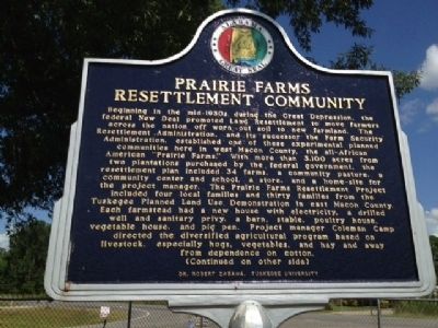
1. Prairie Farms Resettlement Community Marker
Beginning in the mid-1930s during the Great Depression, the federal New Deal promoted Land Resettlement to move farmers across the nation off worn out soil to new farmland. The Resettlement Administration, and its successor the Farm Security Administration, established one of these experimental planned communities here in west Macon County, the all-African American “Prairie Farms.” With more than 3,100 acres from two plantations purchased by the federal government, the resettlement plan included 34 farms, a community pasture, a community center and school, a store, and a home-site for the project manager. The Prairie Farms Resettlement Project included four local families and 30 families from the Tuskegee Planned Land Use Demonstration in east Macon County. Each farmstead had a new house with electricity, a drilled well and sanitary privy, a barn, stable, poultry house, vegetable house, and pig pen. Project manager Coleman Camp directed the diversified agricultural program based on livestock, especially hogs, vegetables, and hay and away from dependence on cotton.
this page online
Erected 2012 by Dr. Robert Zabawa, Tuskegee University.
Topics and series. This historical marker is listed in these
Photographed by Mark Hilton, August 12, 2013
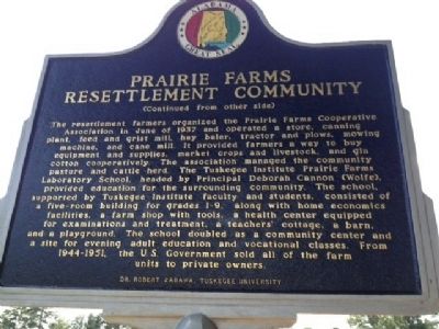
2. Reverse of Marker
Location. 32° 22.949′ N, 85° 59.403′ W. Marker is in Shorter, Alabama, in Macon County. It is at the intersection of Auburn Street (U.S. 80) and Tysonville Road (County Highway 97), on the left when traveling north on Auburn Street. Touch for map. Marker is at or near this postal address: 45 Tysonville Road, Shorter AL 36075, United States of America. Touch for directions.

Regionally, this marker is in the American South, specifically in the Deep South, and in the Black Belt. Globally, it is in North America, a Gulf of Mexico state, the Western Hemisphere, the Western World, and the Anglosphere. Historically, it finds itself in what was once the territory of the Mississippian Culture, one of the Confederate States of America, and the Antebellum South.
Other nearby markers. At least 8 other markers are within 7 miles of this marker, measured as the crow flies: Lucas Tavern (approx. 3.2 miles away); The Oaks Plantation
Photographed by Mark Hilton, August 12, 2013
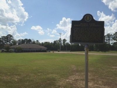
3. Prairie Farms Recreation Center
Also see . . . Prairie Farms Resettlement Community. The Encyclopedia of Alabama entry (Submitted on August 23, 2013, by Mark Hilton of Montgomery, Alabama.)
Credits. This page was last revised on October 4, 2020. It was originally submitted on August 22, 2013, by Mark Hilton of Montgomery, Alabama. This page has been viewed 1,620 times since then and 54 times this year. Photos: 1, 2, 3. submitted on August 22, 2013, by Mark Hilton of Montgomery, Alabama. • Bernard Fisher was the editor who published this page.
