Sullivan's Island in Charleston County, South Carolina — The American South (South Atlantic)
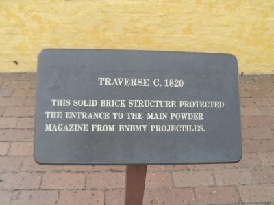
Traverse c.1820
Photographed by Bill Coughlin, August 3, 2013
1. Traverse c.1820 Marker
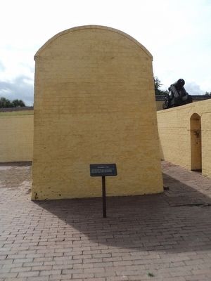
This solid brick structure protected the entrance to the main powder magazine from enemy projectiles.
Topics. This historical marker is listed in these topic lists: Forts and Castles • War, US Civil.
Location. 32° 45.574′ N, 79° 51.486′ W. Marker is on Sullivan's Island, South Carolina, in Charleston County. It can be reached from Middle Street, on the left when traveling east. Marker is located at Fort Moultrie National Monument. Touch for map. Marker is in this post office area: Sullivans Island SC 29482, United States of America. Touch for directions.

Regionally, this marker is in Historic Charleston and in the Lowcountry. It is also in the American South, specifically in the Deep South, and on the Eastern Seaboard. Globally, it is in the North Atlantic Region, North America, the Western Hemisphere, the Western World, and the Anglosphere. Historically, it finds itself in what was once the territory of the Mississippian Culture, one of the original Thirteen Colonies, one of the Confederate States of America, and the Antebellum South.
Other nearby markers. At
this page online
Also see . . . Fort Moultrie. National Park Service website. (Submitted on August 22, 2013, by Bill Coughlin of Woodland Park, New Jersey.)
Photographed by Bill Coughlin, August 3, 2013
2. Traverse c.1820 Marker
Photographed by Bill Coughlin, August 3, 2013
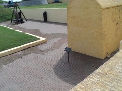
3. Marker at Fort Moultrie
During the Civil Wall, this structure protected the fort during a bombardment.
Credits. This page was last revised on June 16, 2016. It was originally submitted on August 22, 2013, by Bill Coughlin of Woodland Park, New Jersey. This page has been viewed 532 times since then and 14 times this year. Photos: 1, 2, 3. submitted on August 22, 2013, by Bill Coughlin of Woodland Park, New Jersey.
