Huntingtown in Calvert County, Maryland — The American Northeast (Mid-Atlantic)
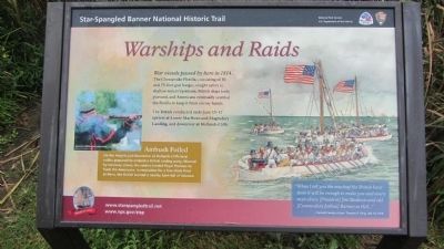
Warships and Raids
Star-Spangled Banner National Historic Trail
| — | National Park Service, U.S. Department of the Interior | — |
Photographed by F. Robby, August 20, 2013
1. Warships and Raids Marker
War vessels passed by here in 1814. The Chesapeake Flotilla, consisting of 50- and 75-foot gun barges, sought safety in shallow waters upstream. British ships hotly pursued, and Americans eventually scuttled the flotilla to keep it from enemy hands.
The British conducted raids June 15-17 upriver at Lower Marlboro and magruders Landing, and downriver at Hollands Cliffs.
Ambush Foiled
On the heights just downriver at Hollands Cliffs local militia prepared to ambush a British raiding party. Warned by runaway slaves, the raiders landed Royal Marines to flank the Americans. In retaliation for a few shots fired at them, the British burned a nearby barn full of tobacco.
"When I tell you the mischief the British have done it will be enough to make you and every man abuse [President] Jim Madison and old [Commodore Joshua] Barney in Hell…" - Calvert County citizen Thomas B. King, July 14, 1814
Erected by National Park Service, U.S. Department of the Interior.
Topics and series. This historical marker is listed in these topic lists: War of 1812 • Waterways & Vessels. In addition, it is included in the
this page online
Location. 38° 37.537′ N, 76° 40.537′ W. Marker is in Huntingtown, Maryland, in Calvert County. It can be reached from Kings Landing Road 2½ miles west of Huntingtown Road. Marker is in Kings Landing Park, at the park's Patuxent River pier. Touch for map. Marker is in this post office area: Huntingtown MD 20639, United States of America. Touch for directions.

Regionally, this marker is in Southern Maryland. It is also in the American South, specifically in the Upper South, in the Mid-Atlantic, in the Tidewater, in the Chesapeake Bay Region, and on the Eastern Seaboard. Globally, it is in the North Atlantic Region, North America, the Western Hemisphere, the Western World, and the Anglosphere. Historically, it finds itself in what was once one of the original Thirteen Colonies and also the Antebellum South.
Other nearby markers. At least 8 other markers are within 5 miles of this marker, measured as the crow flies: Camp Mohawk (approx. 0.3 miles away); Up in Flames (approx. 1.4 miles away); Lower Marlboro Town (approx.
Photographed by F. Robby, August 20, 2013
2. Warships and Raids Marker
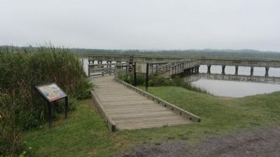
Marker is on the left, aside the Patuxent River pier.
Another marker is no longer nearby. Lower Marlboro (was approx. 2.1 miles away but has been confirmed missing).
Additional keywords. Star Spangled Banner National Historic Trail
Photographed by F. Robby, August 20, 2013
3. Chesapeake Gateways Marker
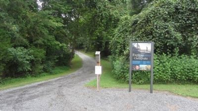
This marker is at the end of the road, and at the head of the trail leading to the Warships and Raids marker.
Photographed by F. Robby, August 20, 2013
4. The Long Journey Marker
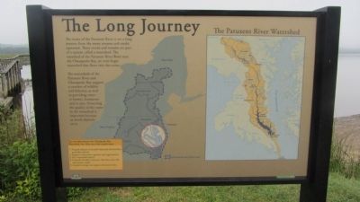
This marker, next to the Warships and Raids marker, describes the Patuxent River and Chesapeake Bay watersheds.
Photographed by F. Robby, August 20, 2013
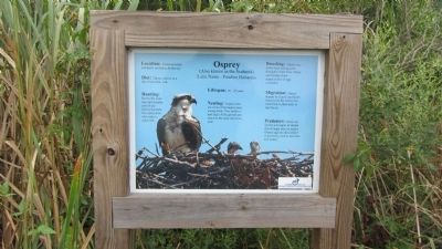
5. Osprey Marker
This marker, near the Warships and Raids marker, provides information on Osprey habitats in the Patuxent River vicinity.
Photographed by F. Robby, August 20, 2013
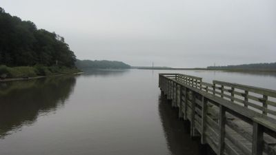
6. Patuxent River
Looking south.
Photographed by F. Robby, August 20, 2013
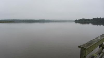
7. Patuxent River
Looking north.
Credits. This page was last revised on August 2, 2026. It was originally submitted on August 23, 2013, by F. Robby of Baltimore, Maryland. This page has been viewed 1,008 times since then and 33 times this year. Photos: 1, 2, 3, 4, 5, 6, 7. submitted on August 24, 2013, by F. Robby of Baltimore, Maryland.
