Asbury in Warren County, New Jersey — The American Northeast (Mid-Atlantic)
The Plenge Archaeological Site
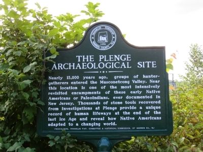
Photographed by Alan Edelson, August 27, 2013
1. The Plenge Archaeological Site Marker
Erected 2013 by Franklin Township Historical Commission.
Topics. This historical marker is listed in this topic list: Indigenous Peoples and Communities.
Location. 40° 41.744′ N, 75° 0.625′ W. Marker is in Asbury, New Jersey, in Warren County. It is at the intersection of Asbury - West Portal Road and Maple Ave, on the left when traveling west on Asbury - West Portal Road. Touch for map. Marker is in this post office area: Asbury NJ 08802, United States of America. Touch for directions.

Regionally, this marker is in North Jersey. It is also in the American Northeast and in the Mid-Atlantic. Globally, it is in North America, the
this page online
Other nearby markers. At least 8 other markers are within 3 miles of this marker, measured as the crow flies: McCullough House (a few steps from this marker); Methodist Church of Asbury (about 400 feet away, measured in a direct line); Swayze Mine (approx. 1.7 miles away); Musconetcong Valley Presbyterian Church (approx. 2 miles away); Tower Hill Farm (approx. 2.1 miles away); Sister Mary Miranda C.S.S.F. (approx. 2.4 miles away); Bethlehem Township Veterans Memorial (approx. 2½ miles away); The Lenape Village of Pelouesse (approx. 2½ miles away). Touch for a list and map of all markers in Asbury.
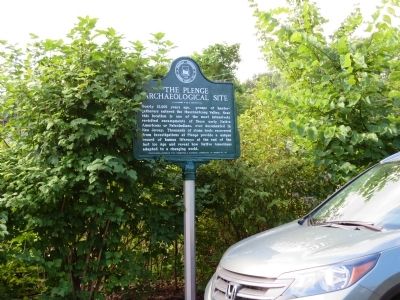
Photographed by Alan Edelson, August 27, 2013
2. The Plenge Archaeological Site Marker
Credits. This page was last revised on June 16, 2016. It was originally submitted on August 27, 2013, by Alan Edelson of Union Twsp., New Jersey. This page has been viewed 5,579 times since then and 420 times this year. Photos: 1, 2. submitted on August 27, 2013, by Alan Edelson of Union Twsp., New Jersey. • Bill Pfingsten was the editor who published this page.
