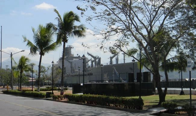
Olongapo in Zambales, Central Luzon, Philippines — Southeast Asia
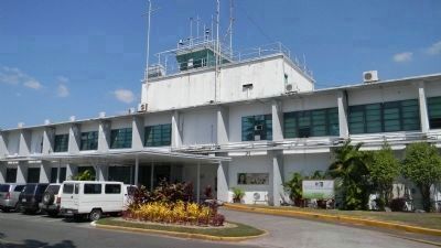
Subic Bay Metropolitan Authority
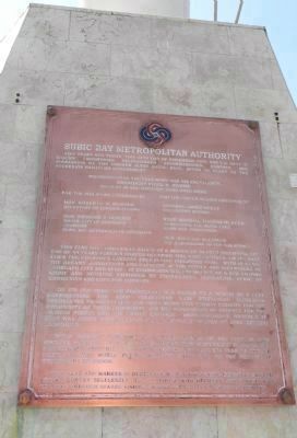
Inscription.
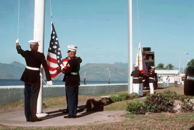
Five years ago today, this 24th day of November 1997, the U.S. Navy in solemn ceremonies relinquished administration, control and possession of the former Subic Naval Base, after 94 years to the sovereign Philippine government.
Presiding over the ceremony was his excellency, President Fidel V. Ramos,
Present in the historic turnover were:
For the Philippine Government:
Hon. Roberio R. Romulo, Secretary of Foreign Affairs
Hon. Richard J. Gordon, Mayor, City of Olongapo; Chairman, Subic Bay Metropolitan Authority
For the United States Government:
Admiral James Kelly, Commander in Chief:
Rear Admiral Thomas Mercer, Commander, U.S. Naval Base Subic Bay, Philippines
Hon. Richard Solomon, U.S. Ambassador to the Philippines
This flag pole originally stood at a height of 94 feet signifying the end of 94 years foreign forces occupied this vast complex . On its mast flies the country’s largest free flying Philippine flag. With it soars the dreams, aspirations and capacity of the people and volunteers of Olongapo City and Subic. It symbolizes the emergence of a new Filipino spirit and attitude embodied by commitment, dedication, sense of community and love for country.
On its 4th year, the foundation was raised to a height of 8 feet, representing the 8,000 volunteers who selflessly dedicated themselves to protecting and preserving this mighty facility for the prosperity of their community and the resurgence of respect for the Filipino people and the entire country. Simultaneously, another 18 was added representing the 18 heads of states of APEC member economies.
Today proudly towering at a total height of 120 feet in this historic pedestal of honor, this mighty flag gloriously heralds the new Filipino spirit into the new millennium, for all sea vessels and air crafts of the world flying majestic Subic Bay. To pay homage in triumphant splendor.
This flag and marker is dedicated to all the volunteers who served their country selflessly, to all those who believed, and those who endured through shared visions, shared struggles and shared triumphs.
Erected 1997 by Subic Bay Metropolitan Authority.
Topics. This historical marker is listed in these topic lists: Forts and Castles • Waterways & Vessels. A significant historical month for this entry is November 1997.
Location. 14° 49.017′ N, 120° 16.833′ E. Marker is in Olongapo, Central Luzon, in Zambales. Marker is on Waterfront Road west of Taft Street. Touch for map. Touch for directions.
Other nearby markers. At least 3 other markers are within walking distance of this marker. Inang Laya Monument (a few steps
from this marker); The Hellships Memorial (within shouting distance of this marker); Old West Gate (approx. 0.3 kilometers away).
Related marker. Click here for another marker that is related to this marker. To better understand the relationship, study each marker in the order shown.
Also see . . . Port of Subic Bay. ... The development of the towns of Subic and Olongapo followed the development of the US Navy base at the Port of Subic Bay. At one time, it was the US’ biggest naval base in Asia. It continued to be an important naval facility until 1991. In 1991, the Philippine Senate decided not to renew the lease on the US naval base at the Port of Subic Bay. The US Navy had already started down-sizing its operations when Mount Pinatubo (about 36 kilometers north of the Port of Subic Bay) presented one of the biggest volcanic eruptions of the previous century. The Navy base was covered in ash, and several structures collapsed. The USS Belleau was the last US ship to leave the Port of Subic Bay in late 1992. Upon the Americans’ departure, the Port of Subic Bay was converted into commercial use, mainly through the efforts of the residents of Olongapo City and its mayor. Since then, the Port of Subic Bay has become a model for the conversion of military bases to commercial use. Many blue chip companies have invested billions of dollars,
creating 70 thousand jobs in the Port of Subic Bay in its first four years. The Port of Subic Bay hosted the APEC Leaders’ Summit in 1996.
The Port of Subic Bay is not just a commercial enterprise. Subic Bay is a popular vacation spot for residents of Manila who come to enjoy the beaches, visit the underwater aquarium, take jungle survival tours, or shop at the duty-free shopping centers. (Submitted on August 28, 2013, by Richard E. Miller of Oxon Hill, Maryland.)
Additional keywords. Subic Bay Freeport Zone (SBFZ)

Photographed By Richard E. Miller, January 29, 2013
4. View from near the Subic Bay Metropolitan Authority headquarters - across Waterfront Road
Credits. This page was last revised on February 12, 2022. It was originally submitted on August 27, 2013, by Richard E. Miller of Oxon Hill, Maryland. This page has been viewed 1,430 times since then and 119 times this year. Photos: 1, 2. submitted on August 27, 2013, by Richard E. Miller of Oxon Hill, Maryland. 3, 4. submitted on August 28, 2013, by Richard E. Miller of Oxon Hill, Maryland. • Andrew Ruppenstein was the editor who published this page.


