Heislerville in Cumberland County, New Jersey — The American Northeast (Mid-Atlantic)
A Guiding Light
Aids to Navigation
— Maritime History —
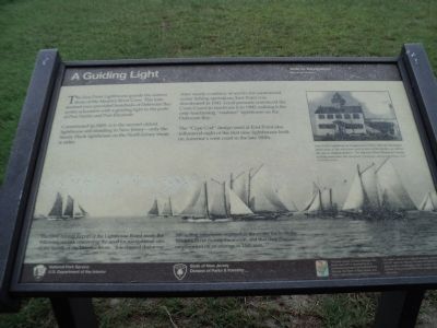
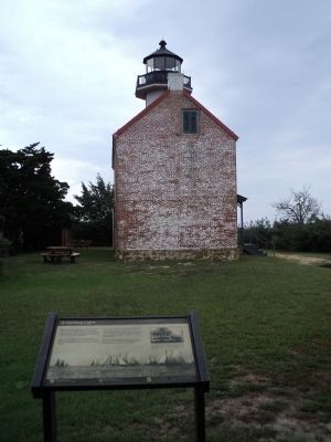
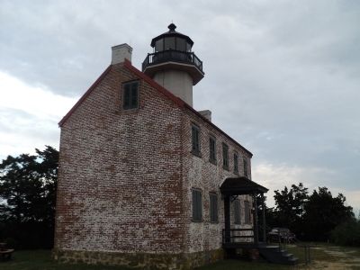
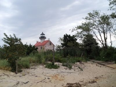
The East Point Lighthouse guards the eastern shore of the Maurice River Cove. This lone sentinel once provided hundreds of Delaware Bay oyster schooners with a guiding light to the ports at Port Norris and Port Elizabeth.
Constructed in 1849, it is the second oldest lighthouse still standing in New Jersey – only the Sandy Hook lighthouse on the North Jersey shore is older.
After nearly a century of service for commercial oyster fishing operations, East Point was deactivated in 1941. Local pressure convinced the Coast Guard to reactivate it in 1980, making it the only functioning “onshore” lighthouse on the Delaware Bay.
The “Cape Cod” design used at East Point also influenced eight of the first nine lighthouses built on America’s west coast in the late 1800s.
Erected by National Park Service & the State of New Jersey.
Topics and series. This historical marker is listed in these topic lists: Industry & Commerce • Waterways & Vessels. In addition, it is included in the Lighthouses series list. A significant historical year for this entry is 1849.
Location. 39° 11.758′ N, 75° 1.655′ W. Marker is in Heislerville, New Jersey, in Cumberland County. Marker can be reached from Lighthouse Road, 0.1 miles west of E Point Road, on the left when traveling west. Touch for map. Marker is in this post office area: Heislerville NJ 08324, United States of America. Touch for directions.
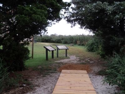
Other nearby markers. At least 8 other markers are within 3 miles of this marker, measured as the crow flies. All Shapes, Sizes and Materials (here, next to this marker); East Point Lighthouse (within shouting distance of this marker); Maurice River (approx. 2.6 miles away); Steps to Harvest Oysters and Bring to Market (approx. 2.6 miles away); a different marker also named Steps to Harvest Oysters and Bring to Market (approx. 2.6 miles away); The Schooner AJ Meerwald (approx. 2.6 miles away); Delaware Bay and River (approx. 2.6 miles away); Bivalve Oyster Shipping Sheds (approx. 2.6 miles away). Touch for a list and map of all markers in Heislerville.
More about this marker. The bottom of the marker contains a photo of sailing vessels in the water, and includes the caption “The 1894 Annual Report of the Lighthouse Board made the following remark concerning the need for navigational aids at the mouth of the Maurice River: ‘It is claimed that some 500 sailing vessels are engaged in the oyster trade on the Maurice River during the season, and that they give employment on an average to 1500 men . . . ”
A photo of the East Point Lighthouse appears at the upper right of the marker. The caption reads “East Point
Lighthouse as it appeared in 1913. Note the developed porch area at the entry door and in front of the kitchen, as well as the use of window shutters. The Maurice River Historical Society actively maintains the structure. (Photograph courtesy of the Maurice River Historical Society).”
Credits. This page was last revised on June 16, 2016. It was originally submitted on September 1, 2013, by Bill Coughlin of Woodland Park, New Jersey. This page has been viewed 338 times since then and 9 times this year. Photos: 1, 2, 3, 4, 5. submitted on September 1, 2013, by Bill Coughlin of Woodland Park, New Jersey.
