Harrodsburg in Mercer County, Kentucky — The American South (East South Central)
Graham Springs
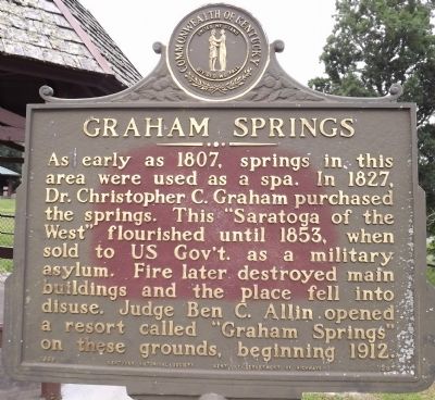
Photographed by Ken Smith, August 18, 2013
1. Graham Springs Marker
Erected 1969 by Kentucky Historical Society & Kentucky Department of Highways. (Marker Number 1297.)
Topics and series. This historical marker is listed in these topic lists: Science & Medicine • Settlements & Settlers. In addition, it is included in the Kentucky Historical Society series list. A significant historical year for this entry is 1807.
Location. 37° 45.359′ N, 84° 50.866′ W. Marker is in Harrodsburg, Kentucky, in Mercer County. It is on Linden Avenue north of Fairground Road, on the left when traveling north. Touch for map. Marker is in this post office area: Harrodsburg KY 40330, United States of America. Touch for directions.

Regionally, this marker is in the Bluegrass Region. It is also in the American South and specifically
this page online
Other nearby markers. At least 8 other markers are within walking distance of this marker: An Early Derby Winner / Another Derby Winner (about 300 feet away, measured in a direct line); Mercer County Fair and Horse Show (about 600 feet away); Harrodsburg Springs (approx. 0.2 miles away); Tabler House (approx. ¼ mile away); Poteet House (approx. ¼ mile away); VanArsdall / Sale House (approx. ¼ mile away); Dedman House (approx. ¼ mile away); G. A. Curry House (approx. ¼ mile away). Touch for a list and map of all markers in Harrodsburg.
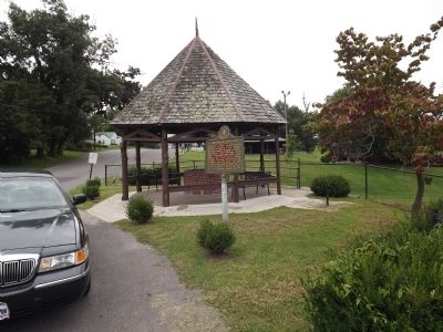
Photographed by Ken Smith, August 18, 2013
2. Graham Springs Marker
Credits. This page was last revised on June 16, 2016. It was originally submitted on September 1, 2013, by Ken Smith of Milan, Tennessee. This page has been viewed 1,340 times since then and 75 times this year. Photos: 1. submitted on September 2, 2013, by Ken Smith of Milan, Tennessee. 2. submitted on September 1, 2013, by Ken Smith of Milan, Tennessee. • Al Wolf was the editor who published this page.
