Eatontown in Monmouth County, New Jersey — The American Northeast (Mid-Atlantic)
Myer Park
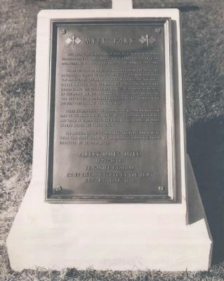
1. Myer Park Memorial
While serving as an assistant surgeon in the Army, he developed a simple visual signaling system which in 1860 was adopted by the Army. In 1860 Myer became the first signal officer with the rank of Major and when the Signal Corps was established in 1863 as a separate branch of the Army, he was promoted to Colonel. In 1865 he was brevetted a Brigadier General in recognition of his services during the Civil War.
Under his leadership the signal corps became an integral part of the Army and Congress recognized its efficiency and value by establishing the first United States Weather Bureau under its supervision.
The insignia of the Signal Corps--the flags and torch--were the first means of military communication employed by General Myer.
Albert James Myer
1827-1880
Brigadier General
Chief Signal Officer of the Army
1860-63, 1866-1880
Topics. This historical marker is listed in these topic lists: Military • War, US Civil. A significant historical year for this entry is 1860.
Location. Marker
this page online

Regionally, this marker was in Central Jersey and in the New York City Metropolitan Area. It was also in the American Northeast, in the Mid-Atlantic, and on the Eastern Seaboard. Globally, it was in the North Atlantic Region, North America, the Western Hemisphere, the Western World, and the Anglosphere. Historically, it found itself in what was once New Netherland and also one of the original Thirteen Colonies.
Other nearby markers. At least 8 other markers are within walking distance of this location: The Old Forge (approx.
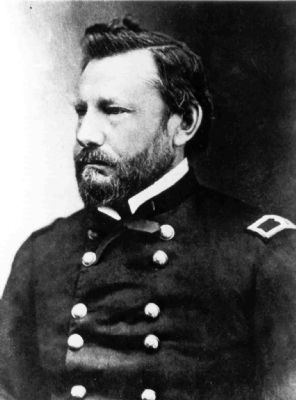
2. BG Albert J Myer
More about this marker. Section III, General Orders Number 22, Headquarters Fort Monmouth, dated April 9, 1949, designated the triangular area east of Russell Hall (near the flagpole) and west of Oceanport Avenue as Myer Park. General Orders Number 48, dated 24 June 1961, “Designation of Cowan Park” later rescinded GO 22 and renamed that area Cowan Park. Myer Park relocated to the area around Building 1207.
Regarding Myer Park. On 3 March 1863, President Abraham Lincoln signed legislation making the Signal Corps a separate military branch. Major Myer was appointed as the first Chief Signal Officer with the rank of Colonel. He would continue to lead the Signal Corps for two and a half decades.
Credits. This page was last revised on February 6, 2026. It was originally submitted on March 26, 2008, by Chrissie Tate Reilly of Fort Monmouth, New Jersey. This page has been viewed 1,551 times since then and 42 times this year. Last updated on April 2, 2008, by Chrissie Tate Reilly of Fort Monmouth, New Jersey. Photos: 1, 2. submitted on March 26, 2008, by Chrissie Tate Reilly of Fort Monmouth, New Jersey. • Kevin W. was the editor who published this page.
Editor’s want-list for this marker. A wide shot of the marker in context. • Can you help?
