Carthage in Smith County, Tennessee — The American South (East South Central)
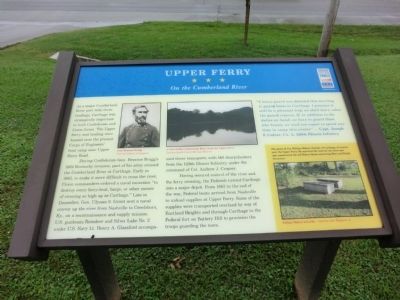
Upper Ferry
On the Cumberland River
As a major Cumberland River port with three landings, Carthage was strategically important to both Confederate and Union forces. The Upper Ferry and landing was located near the present Corps of Engineer boat ramp near Upper Ferry Road.
During Confederate Gen. Braxton Bragg’s 1862 Kentucky invasion, part of his army crossed the Cumberland River at Carthage. Early in 1863, to make it more difficult to cross the river, Union commanders ordered a naval excursion “to destroy every ferry-boat, barge, or other means of crossing as high up as Carthage.” Late in December, Gen. Ulysses S. Grant sent a naval convoy up the river from Nashville to Creelsboro, Ky., on a reconnaissance and supply mission. U.S. gunboats Reindeer and Silver Lake No. 2 under U.S. Navy Lt. Henry A. Glassford accompanied three transports with 140 sharpshooters from the 129th Illinois Infantry, under the command of Col. Andrew J. Cropsey.
Having secured control of the river and the ferry crossing, the Federals turned Carthage into a major depot. From 1863 to the end of the war, Federal boats arrived from Nashville to unload supplies at Upper Ferry. Some of the supplies were transported overland by way of Eastland Heights and through Carthage to the Federal fort on Battery Hill to provision the troops guarding the town.
“A heavy guard was detailed this morning to guard boats to Carthage. I presume it will be a pleasant trip; we shall learn when the guard returns. If, in addition to the duties on hand, we have to guard them (the boats), we need not expect to spend any time in camp this winter.” — Capt. Joseph F. Culver, Co. A, 129th Illinois Infantry
(sidebar)
The grave of Col. William Walton, founder of Carthage, is located near the Upper Ferry. He surveyed the land for the town and also constructed the old Walton Road connecting West and Middle Tennessee.
(captions)
Gen. Braxton Bragg Courtesy Library of Congress
A view of the Cumberland River, from the Upper Ferry. Courtesy Smith County Heritage Museum
William Walton and wife. - Courtesy John Waggoner, Jr.
Erected by Tennessee Civil War Trails.
Topics and series. This historical marker is listed in this topic list: War, US Civil. In addition, it is included in the Tennessee Civil War Trails series list. A significant historical year for this entry is 1862.
Location. 36° 14.7′ N, 85° 56.65′ W. Marker is in Carthage, Tennessee, in Smith County. Marker is on Upper Ferry Road west of Bypass Tennessee Route 25, on the right when traveling west. The marker is on the grounds of Smith County Community Center. Touch for map. Marker is at or near this postal address: 939 Upper Ferry Road, Carthage TN 37030, United States of America. Touch for directions.
Other nearby markers. At least 8 other markers are within walking distance of this marker. Cordell Hull Memorial Bridge (approx. 0.6 miles away); Bragg Invades Kentucky (approx. 0.6 miles away); Confederacy Memorial (approx. 0.6 miles away); Captain William Walton (approx. 0.6 miles away); Benton McMillin (approx. 0.6 miles away); Smith County Courthouse Square (approx. 0.6 miles away); Smith County Veterans Memorial (approx. 0.6 miles away); DeFord Bailey (approx. 0.6 miles away). Touch for a list and map of all markers in Carthage.
Credits. This page was last revised on June 16, 2016. It was originally submitted on September 3, 2013, by Don Morfe of Baltimore, Maryland. This page has been viewed 795 times since then and 26 times this year. Photos: 1, 2, 3. submitted on September 3, 2013, by Don Morfe of Baltimore, Maryland. • Bernard Fisher was the editor who published this page.


