Near Columbia in Tuolumne County, California — The American West (Pacific Coastal)
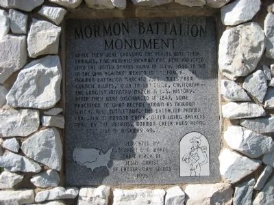
Mormon Battalion Monument
Erected 1995 by Sonora I & II Wards, The Church of Jesus Christ of Latter-Day Saints.
Topics and series. This historical marker and monument is listed in these topic lists: Notable Events • War, Mexican-American. In addition, it is included in the Mormon Battalion series list. A significant historical month for this entry is July 1846.
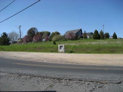
Location. 37° 59.317′ N, 120° 26.516′ W. Marker is near Columbia, California, in Tuolumne County. Marker is at the intersection of State Highway 49 and Rawhide Road (County Highway E5), on the right when traveling north on State Highway 49. Marker is 5.8 miles north of the town of Sonora. Touch for map. Marker is in this post office area: Columbia CA 95310, United States of America. Touch for directions.
Other nearby markers. At least 8 other markers are within 3 miles of this marker, measured as the crow flies. Tuttletown (approx. 1.1 miles away); The Humbug Mine (approx. 1˝ miles away); Mark Twain Cabin (approx. 1˝ miles away); a different marker also named Mark Twain Cabin (approx. 2 miles away); a different marker also named Mark Twain Cabin (approx. 2 miles away); Shaw’s Flat (approx. 2.4 miles away); 75 Pound Nugget (approx. 2.6 miles away); Red Light District (approx. 2.6 miles away). Touch for a list and map of all markers in Columbia.
Also see . . . Mormon Battalion. Wikipedia entry. (Submitted on September 12, 2020, by Larry Gertner of New York, New York.)
Credits. This page was last revised on September 12, 2020. It was originally submitted on April 2, 2008, by Richard Wisehart of Sonora, California. This page has been viewed 2,882 times since then and 55 times this year. Photos: 1, 2. submitted on April 2, 2008, by Richard Wisehart of Sonora, California. • Kevin W. was the editor who published this page.

