Near Angels Camp in Calaveras County, California — The American West (Pacific Coastal)
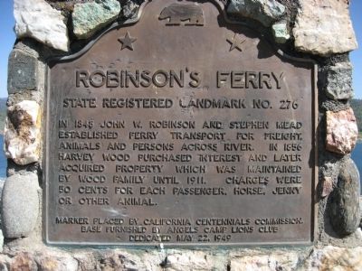
Robinson's Ferry
Erected 1949 by California Centennial Commission with base furnished by Angels Camp Lions Club. (Marker Number 276.)
Topics and series. This historical marker is listed in these topic lists: Notable Places • Waterways & Vessels. In addition, it is included in the California Historical Landmarks series list. A significant historical year for this entry is 1848.
Location. 38° 0.545′ N, 120° 30.285′ W. Marker is near Angels Camp, California, in Calaveras County. Marker is on State Highway 49, on the left when traveling south. Marker is 5.6 miles south of Angels Camp and 0.3 miles north of New Melones Reservoir. Touch for map. Marker is in this post office area: Angels Camp CA 95222, United States of America. Touch for directions.
Other nearby markers. At least 8 other markers are within 3 miles of this marker, measured as the crow flies. Archie D. Stevenot (here, next to this marker); The Story Under the Lake (approx. one mile away); Archie Stevenot (approx. 1.3 miles away); Carson Hill (approx. 1.3 miles away); James H. Carson (approx. 1.3 miles away); Mark Twain Cabin (approx. 1.7 miles away); a different marker also named Mark Twain Cabin (approx. 1.7 miles away); a different marker also named Mark Twain Cabin (approx. 2.3 miles away). Touch for a list and map of all markers in Angels Camp.

Photographed By Richard Wisehart, March 21, 2008
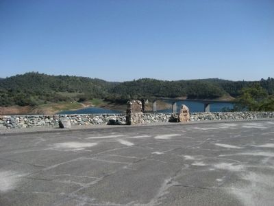
2. Robinson's Ferry Marker
View is southerly with New Melones Reservoir and Highway 49 crossing the Stevenot-Stanislaus River Bridge is visible beyond marker. Additional marker commemorating Archie D. Stevenot can be seen to right of Robinson's Ferry marker.

Photographed By Richard Wisehart, March 9, 2002
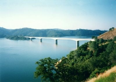
3. New Melones Reservoir
View is southerly. The Stevenot - Stanislaus River Bridge, seen in this photo, is in the approximate location of where John Robinson and Stephen Mead operated their ferry. The Robinson's Ferry monument is just off the right edge of photo.

June 13, 2010
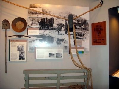
4. Information on Display at the New Malones Reservoir Visitor Center
Credits. This page was last revised on June 16, 2016. It was originally submitted on April 2, 2008, by Richard Wisehart of Sonora, California. This page has been viewed 2,858 times since then and 65 times this year. Photos: 1, 2, 3. submitted on April 2, 2008, by Richard Wisehart of Sonora, California. 4. submitted on June 18, 2010. • Kevin W. was the editor who published this page.
