Castalian Springs in Sumner County, Tennessee — The American South (East South Central)
Thomas Sharpe Spencer Memorial
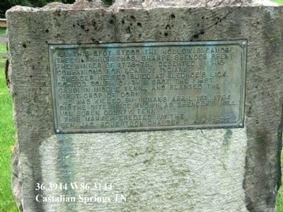
Photographed by Don Morfe, July 23, 2013
1. Thomas Sharpe Spencer Memorial Marker
Erected 1927 by Gen. Jas. Robertson Chapter D.A.R.
Topics and series. This memorial is listed in these topic lists: Settlements & Settlers • War, French and Indian. In addition, it is included in the Daughters of the American Revolution (DAR) series list. A significant historical date for this entry is April 1, 1862.
Location. 36° 23.667′ N, 86° 18.867′ W. Memorial is in Castalian Springs, Tennessee, in Sumner County. It is on Old Highway 25 west of Governor Hall Road, on the left when traveling west. Touch for map. Memorial is in this post office area: Castalian Springs TN 37031, United States of America. Touch for directions.

Regionally, this memorial is in Middle Tennessee and in Greater Nashville. It is also in the American South and specifically
this page online
Other nearby markers. At least 8 other markers are within walking distance of this marker: Wynnewood (about 500 feet away, measured in a direct line); William Brimage Bate (approx. 0.2 miles away); General William Hall (approx. ¼ mile away); Bledsoe's Lick (approx. ¼ mile away); A Typical Settler's Cabin (approx. 0.4 miles away); Unsettled and Dangerous Years (approx. 0.4 miles away); Nathaniel Parker, Hunter and Explorer (approx. 0.4 miles away); The Nathaniel Parker Log Cabin (approx. 0.4 miles away). Touch for a list and map of all markers in Castalian Springs.
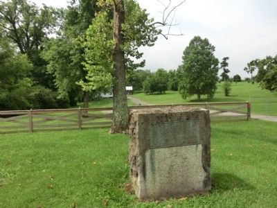
Photographed by Don Morfe, July 23, 2013
2. Thomas Sharpe Spencer Memorial Marker
Credits. This page was last revised on June 16, 2016. It was originally submitted on September 7, 2013, by Don Morfe of Baltimore, Maryland. This page has been viewed 1,212 times since then and 68 times this year. Photos: 1, 2. submitted on September 7, 2013, by Don Morfe of Baltimore, Maryland. • Al Wolf was the editor who published this page.
