Shiner in Lavaca County, Texas — The American South (West South Central)
Half Moon
Photographed by Richard Denney, November 30, 2012
1. Half Moon Marker
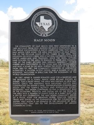
In 1887, Henry B. Shiner donated land for a railroad and the building of a town, which later became known as Shiner. For a short while, the area was known as New Half Moon. Once the Aransas Pass Railroad switch was constructed on Shiner's land, transportation bypassed Half Moon and the town's activity and population
this page online
Marker is property of the State of Texas
Erected 2011 by Texas Historical Commission. (Marker Number 16962.)
Topics. This historical marker is listed in these topic lists: Indigenous Peoples and Communities • Railroads & Streetcars • Settlements & Settlers • War, Texas Independence. A significant historical year for this entry is 1689.
Location. 29° 26.112′ N, 97° 11.902′ W. Marker is in Shiner, Texas, in Lavaca County. It is at the intersection of County Route 533 and County Route 342, on the left when traveling south on County Route 533. Touch for map. Marker is in this post office area: Shiner TX 77984, United
Photographed by Richard Denney, November 30, 2012
2. Half Moon Marker
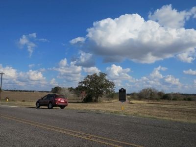
View of marker in context

Regionally, this marker is in the American South and on the Gulf Coast. Globally, it is in North America, a Gulf of Mexico state, the Western Hemisphere, the Western World, and the Anglosphere. Historically, it finds itself in what was once New Spain, the Republic of Texas, one of the Confederate States of America, and the Antebellum South.
Other nearby markers. At least 8 other markers are within 2 miles of this marker, measured as the crow flies: Herder Half Moon Place (approx. 0.9 miles away); SPJST Shiner Cemetery (approx. 1.2 miles away); All Veterans Memorial (approx. 1.3 miles away); Shiner Cemetery (approx. 1.4 miles away); Shiner Game and Fish Protective League (approx. 1.4 miles away); Shiner Colored Cemetery (approx. 1½ miles away); Shiner, Texas (approx. 1½ miles away); Captain Charles Welhausen (approx. 1½ miles away). Touch for a list and map of all markers in Shiner.
Photographed by Richard Denney
3. Half Moon Marker
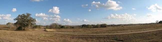
Panorama of country behind the marker where Half Moon was located.
Credits. This page was last revised on June 16, 2016. It was originally submitted on September 8, 2013, by Richard Denney of Austin, Texas. This page has been viewed 1,563 times since then and 77 times this year. Photos: 1, 2, 3. submitted on September 8, 2013, by Richard Denney of Austin, Texas. • Bernard Fisher was the editor who published this page.
