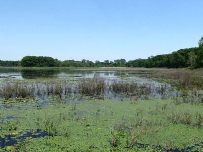
Near Elkhart in Elkhart County, Indiana — The American Midwest (Great Lakes)
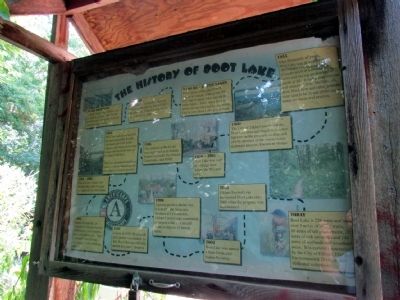
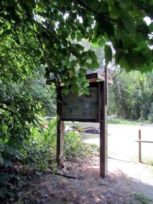
The History of Boot Lake
An Icy Beginning
Millions of years ago Elkhart was covered by glaciers. The Glaciers moved south, eroding the land collecting glacial drift.
9,000 BC
The glaciers eventually began to retreat north, leaving behind their glacial drift. Elkhart is covered in 122 feet of this drift.
9,000 BC - Kettle Lakes
Some parts of the glacier took longer to retreat, settling into clay and forming lakes known as kettle lakes. These lakes have no inlets and are only fed by rainwater. This is how Boot Lake was formed.
1955
After thousands of years, Boot Lake was described by the Indiana Department of Conservation as covering 80 acres and having an average of depth of 4 ft. It had a mud bottom and contained fish. Buffalo, elk, deer, black bear and other animals were said to be found in the areas many wetlands and prairies.
1960
The City of Elkhart purchased the Boot Lake area and began to use two lagoons on the property to disposed of a by-product of the waste-water treatment process, known as sludge.
1970 - 1991
Boot Lake was used as a sludge farm during the 70's and 80's.
1985
The wetlands of Boot Lake were registered as an Indiana Natural Area with The Natural Conservancy and IDNR.
1991
The City realized the need for an environmentally friendly alternative for solid waste disposal and began processing sludge into biosolids that can be used as fertilizer.
1991 - 1994
Over the next 3 years, over 88,000 cubic yards of sludge was removed from Boot Lake.
1994
Elkhart EnviroCorps, an AmeriCorps National Service Organization, was formed to help restore Boot Lake. They removed 40 tons of trash and created 2 miles of hiking trails.
1995
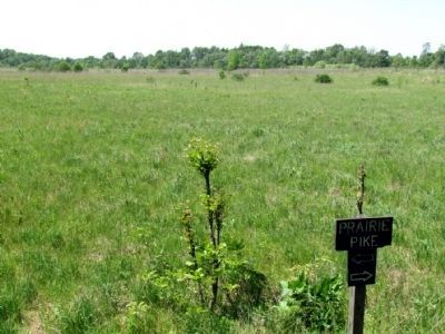
In June of 1995, 20 acres tall grass prairie was planted. In July, Boot lake was officially opened as a nature preserve.
1996
A picnic pavilion shelter was donated by the Associated Builders and Contractors. Elkhart EnviroCorps constructed a compost toilet as a natural means to dispose of human waste.
2003
Boot Lake was named a State Dedicated Nature Preserve.
2008
Elkhart EnviroCorps maintained Boot Lake until 2008 when the program was discontinued.
Today
Boot Lake is 226 acres and has over 3 miles of hiking trails, 60 acres of tall grass prairie, 20 acres of oak savannah and 146 acres of wetlands and woodland areas. It is currently maintained by the City of Elkhart, Elkhart Environmental Division and dedicated volunteers.
Topics. This historical marker is listed in this topic list: Environment
. A significant historical month for this entry is June 1995.
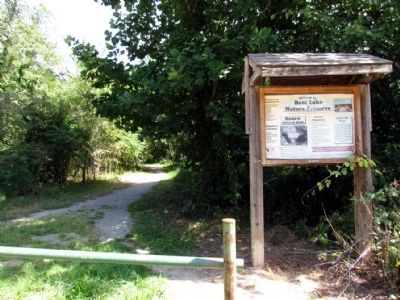
Location. 41° 44.805′ N, 86° 0.924′ W. Marker is near Elkhart, Indiana, in Elkhart County. Marker can be reached from Williams Lane, 0.4 miles east of County Road 3. Marker is located at the end of Williams Lane next to the parking lot for Boot Lake Nature Preserve. Touch for map. Marker is in this post office area: Elkhart IN 46514, United States of America. Touch for directions.
Other nearby markers. At least 8 other markers are within 5 miles of this marker, measured as the crow flies. Trooper Richard T. Gaston, PE# 6679 (approx. 1.1 miles away); Ambrose G. Bierce (approx. 4 miles away); Havilah Beardsley (approx. 4.2 miles away); The Havilah Beardsley House (approx. 4.2 miles away); Main St. Memorial Bridge (approx. 4.3 miles away); Ruthmere (approx. 4.3 miles away); Development of Diagnostic Test Strips (approx. 4.3 miles away); Village of Pulaski (approx. 4.4 miles away). Touch for a list and map of all markers in Elkhart.
Also see . . . Boot Lake Nature Preserve. City of Elkhart website entry (Submitted on September 9, 2013.)
Credits. This page was last revised on August 13, 2021. It was originally submitted on September 9, 2013, by Duane Hall of Abilene, Texas. This page has been viewed 960 times since then and 52 times this year. Photos: 1, 2, 3, 4, 5. submitted on September 9, 2013, by Duane Hall of Abilene, Texas.
