Port Carbon in Schuylkill County, Pennsylvania — The American Northeast (Mid-Atlantic)
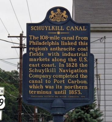
Schuylkill Canal
Photographed by PaulwC3, August 3, 2013
1. Schuylkill Canal Marker
Erected 1994 by Pennsylvania Historical and Museum Commission.
Topics and series. This historical marker is listed in this topic list: Waterways & Vessels. In addition, it is included in the Pennsylvania Historical and Museum Commission (PHMC) series list. A significant historical year for this entry is 1828.
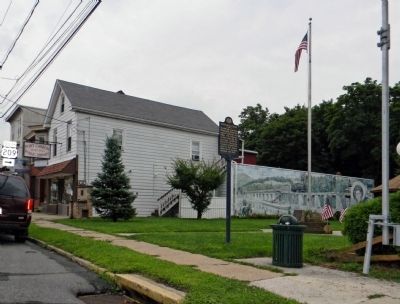
Location. 40° 41.72′ N, 76° 9.989′ W. Marker is in Port Carbon, Pennsylvania, in Schuylkill County. It is at the intersection of Pike Street and Pine Street, on the right when traveling east on Pike Street. The marker is located in the Veterans Memorial Park next to the Janet Eich Library. Touch for map. Marker is at or near this postal address: 111 Pike Street, Port Carbon PA 17965, United States of America. Touch for directions.

Regionally, this marker is in Anthracite Coal Region. It is also in the American Northeast, in the Mid-Atlantic, in Appalachia,
this page online
Other nearby markers. At least 8 other markers are within 2 miles of this marker, measured as the crow flies: Veterans of Port Carbon (a few steps from this marker); Firth Dock (1828-1871) (approx. 0.4 miles away); Anthracite Region Veterans Memorial (approx. 0.6 miles away); Vietnam Veterans Memorial (approx. 0.6 miles away); Congressional Medal of Honor Memorial (approx. 1.1 miles away); Veterans Memorial (approx. 1.1 miles away); American House - C.F. Jackson (approx. 1.6 miles away); Jerry's Classic Cars & Collectibles Museum (approx. 1.6 miles away). Touch for a list and map of all markers in Port Carbon.
Also see . . . History of the Schuylkill Navigation System. The system was most prosperous between 1835 and 1841 although its record tonnage, nearly two million tons, occurred in 1859. During the second half of the 19th century the rise of the railroad, floods, droughts, and a miners' strike contributed to the downfall of the system.
Photographed by PaulwC3, August 3, 2013
2. Wide view of the Schuylkill Canal Marker
Credits. This page was last revised on June 16, 2016. It was originally submitted on September 10, 2013, by PaulwC3 of Northern, Virginia. This page has been viewed 987 times since then and 26 times this year. Photos: 1, 2. submitted on September 10, 2013, by PaulwC3 of Northern, Virginia.
Editor’s want-list for this marker. Photos of the ruins of at the northern terminus of the canal • Can you help?
