Near Portland in Robertson County, Tennessee — The American South (East South Central)
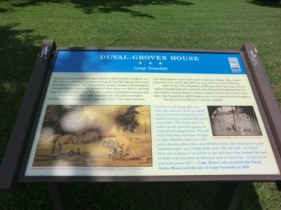
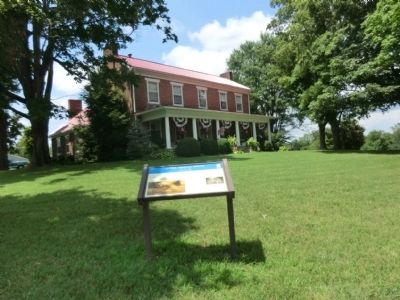
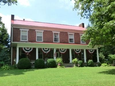
Duval-Groves House
Camp Trousdale
Established in 1861, Camp Trousdale was relocated twice before settling permanently just under a mile east of here. The camp contained tents and temporary huts constructed on Summers Beach. Most soldiers arrived by train, and by July 1861, the camp held more than 6,000 men.
After the fall of Fort Donelson in February 1862, thousands of Union soldiers streamed past here southward along the Louisville and Nashville Turnpike and the railroad. Because of their numbers and the lack of army provisions, they foraged here and throughout the countryside for food and supplies. The Duval-Groves is a private residence.
“The fine brick house that was near the junction of the turnpike and the branch along which the soldiers went to camp hardly seems a day older. The small grove of cedars in the yard has grown to magnificent proportions. The old drill field does not seem as large as then. Besides, there are well-grown forests where then were tillable fields. The old mill—by which there was a brewery at which we got still beer that looked like buttermilk and was both delicious and as harmless—is still there and well preserved.” — Capt. Hester, who revisited the Duval-Groves House and the site of Camp Trousdale in 1909
(captions)
This idealized view of a “Confederate camp” was published in London in 1871. - Courtesy Library of Congress
Duval-Groves House - Courtesy Robertson County Archives
Erected by Tennessee Civil War Trails.
Topics and series. This historical marker is listed in this topic list: War, US Civil. In addition, it is included in the Tennessee Civil War Trails series list. A significant historical month for this entry is February 1862.
Location. 36° 37.144′ N, 86° 34.373′ W. Marker is near Portland, Tennessee, in Robertson County. Marker is at the intersection of U.S. 31W and Highland Road, on the right when traveling south on U.S. 31W. Touch for map. Marker is in this post office area: Portland TN 37148, United States of America. Touch for directions.
Other nearby markers. At least 8 other markers are within 3 miles of this marker, measured as the crow flies. Triangular Jog (approx. 1.1 miles away in Kentucky); Civil War in Tennessee (approx. 1.2 miles away); AmVets Memorial (approx. 1.2 miles away); Camp Trousdale (approx. 1.4 miles away); Replica of Stone #38 (approx. 1.7 miles away in Kentucky); Oklahoma City Bombing Memorial (approx. 1.7 miles away in Kentucky); Tennessee Maneuvers World War II (approx. 2.3 miles away); Sandford Duncan Inn / Noted Dueling Ground (approx. 2˝ miles away in Kentucky). Touch for a list and map of all markers in Portland.
Credits. This page was last revised on June 16, 2016. It was originally submitted on September 11, 2013, by Don Morfe of Baltimore, Maryland. This page has been viewed 1,180 times since then and 39 times this year. Photos: 1, 2, 3, 4. submitted on September 11, 2013, by Don Morfe of Baltimore, Maryland. • Bernard Fisher was the editor who published this page.


