Clarksville in Montgomery County, Tennessee — The American South (East South Central)
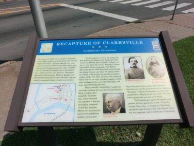
Recapture of Clarksville
Confederate Occupation
The Confederates crossed the bridge over Red River on the Hopkinsville Road and headed toward the Federal base at Steward College (now Austin Peay State University). Johnson’s column searched for Union commander Col. Rodney Mason downtown while Woodward swept toward the college. Mason hurried to the campus when he learned of the attack, but his three hundred soldiers of the 71st Ohio were scattered. Some were stationed at the two railroad bridges; and some patrolled telegraph lines.
Mason initially rebuffed the Confederate surrender demand but soon had second thoughts. Many residents had joined the Confederates, whose strength was reported at 800 but most likely consisted of half that number. Mason also assumed they faced two Confederate artillery pieces, but they were clever fakes produced by Johnson’s partisans and thereby accounting for his nickname, “Stovepipe.” Taking his precarious position into consideration, Mason struck his colors. The 71st Ohio was paroled and sent to Paducah.
The Confederates gathered supplies and planned further operations in the Clarksville vicinity. Soon after, on August 25, Woodward attacked a detachment of the 71st Ohio at Dover but was repulsed, and he fell back to Clarksville.
(captions)
Col. Rodney Mason Courtesy Martin Stewart
Col. Adam R. “Stovepipe” Johnson Courtesy Findagrave.com
Col. Thomas Woodward Courtesy Kentucky Library-Western Kentucky University
Erected by Tennessee Civil War Trails.
Topics and series. This historical marker is listed in this topic list: War, US Civil. In addition, it is included in the Tennessee Civil War Trails series list. A significant historical year for this entry is 1862.
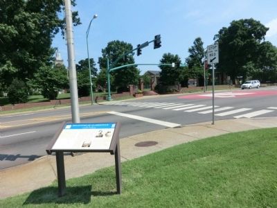
Location. 36° 31.874′ N, 87° 21.24′ W. Marker is in Clarksville, Tennessee, in Montgomery County. Marker is at the intersection of College Street (Tennessee Route 48) and University Avenue (Tennessee Route 112), on the right when traveling east on College Street. Touch for map. Marker is in this post office area: Clarksville TN 37040, United States of America. Touch for directions.
Other nearby markers. At least 8 other markers are within walking distance of this marker. Site of Montgomery County College (within shouting distance of this marker); Austin Peay State University (within shouting distance of this marker); Robert Loftin Newman (about 400 feet away, measured in a direct line); Archwood (about 700 feet away); Asahel Huntington Patch / Patch Foundry (about 800 feet away); Drane-Foust House (approx. 0.2 miles away); St. John Missionary Baptist Church (approx. 0.2 miles away); St. Peter African Methodist Church (approx. 0.2 miles away). Touch for a list and map of all markers in Clarksville.
Credits. This page was last revised on May 11, 2021. It was originally submitted on September 13, 2013, by Don Morfe of Baltimore, Maryland. This page has been viewed 721 times since then and 27 times this year. Photos: 1, 2. submitted on September 13, 2013, by Don Morfe of Baltimore, Maryland. • Bernard Fisher was the editor who published this page.

