Overgaard in Navajo County, Arizona — The American Mountains (Southwest)
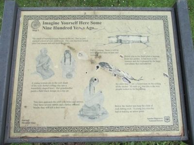
Imagine Yourself Here Some Nine Hundred Years Ago
Stop 3
Inscription.
The smell of burning pinyon lingers in the air. You've just enjoyed a bowl of corn meal mush. The corn has been stored since last season and still feeds the family.
Fall is coming. Soon it will be time to gather pinyon nuts and walnuts.
A young woman sits in the cool shade of the rock shelter coiling clay into a beautifully shaped bowl. Her grandmother paints a bold black design on a clay jar.
Two men approach the cliff with bows and arrows. They have several rabbits and a turkey in hand. Maybe they will kill a deer soon.
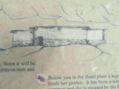
Below you in the flood plain a woman tends her garden. It has been a wet summer and she is pleased by the large corn plants that surround her.
An older man paints a lizard-man on the ceiling of the shelter. He tells you that this is the way people looked in the beginning.
Below the shelter you hear the clink of rock hitting rock. A young boy tries his hand at making an arrow point.
Journey Through Time
Erected by Apache-Sitgreaves National Forest.
Topics. This historical marker is listed in this topic list: Native Americans.
Location. 34° 22.828′ N, 110° 38.217′ W. Marker is in Overgaard, Arizona, in Navajo County . Marker is on Black Canyon Road, on the right when traveling north. Black Canyon Road can be accessed from Highway 260. Touch for map. Marker is in this post office area: Overgaard AZ 85933, United States of America. Touch for directions.
Other nearby markers. At least 3 other markers are within 3 miles of this marker, measured as the crow flies. How Long Has It Been? (approx. 1.2 miles away); Can You Read the Rocks....? (approx. 1.2 miles away); Travel on a Journey Through Time... (approx. 2.7 miles away).
Credits. This page was last revised on June 16, 2016. It was originally submitted on September 15, 2013, by Denise Boose of Tehachapi, California. This page has been viewed 466 times since then and 10 times this year. Photos: 1, 2, 3, 4, 5, 6, 7. submitted on September 15, 2013, by Denise Boose of Tehachapi, California. • Syd Whittle was the editor who published this page.
