Stonington in Southeastern Region, Connecticut — The American Northeast (New England)
Thomas Howe House
Photographed by Michael Herrick, August 27, 2013
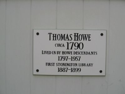
1. Thomas Howe House Marker
Circa 1790
Lived in by Howe Descendants
1797-1957
First Stonington Library
1887-1899
Topics. This historical marker is listed in these topic lists: Arts, Letters, Music • Colonial Era. A significant historical year for this entry is 1790.
Location. 41° 20.039′ N, 71° 54.359′ W. Marker is in Stonington in Southeastern Region, Connecticut. It is on Main Street near Church Street, on the right when traveling south. Touch for map. Marker is at or near this postal address: 52 Main Street, Stonington CT 06378, United States of America. Touch for directions.

Regionally, this marker is on the Connecticut Shoreline, in Greater New London, in Mystic and the Eastern Shore, and in the Thames River Valley. It is also in the American Northeast, in New England, and on the Eastern Seaboard. Globally, it is in the North Atlantic Region, North America, the Western Hemisphere, the Western World, and the Anglosphere. Historically, it finds itself in what was once New London County and also one of the original Thirteen Colonies.
Other nearby markers. At least 8 other markers are within walking distance of
this page online
Photographed by Michael Herrick, August 27, 2013
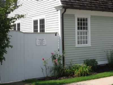
2. Thomas Howe House Marker
Photographed by Michael Herrick, August 27, 2013
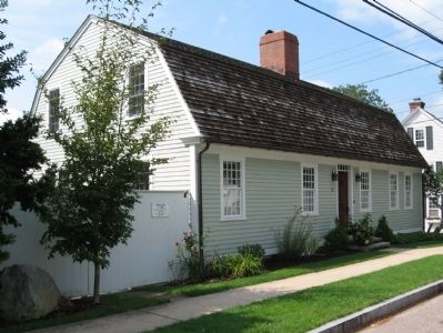
3. Thomas Howe House
Credits. This page was last revised on May 19, 2026. It was originally submitted on September 18, 2013, by Michael Herrick of Southbury, Connecticut. This page has been viewed 989 times since then and 25 times this year. Photos: 1, 2, 3. submitted on September 18, 2013, by Michael Herrick of Southbury, Connecticut.
