Pennsville in Pennsville Township in Salem County, New Jersey — The American Northeast (Mid-Atlantic)
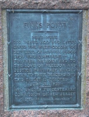
Finns Point
1638-1938
| — | • | — |
Photographed by Keith S Smith, September 20, 2013
1. Finns Point Marker
300 years ago and later
lived the first colony of
settlers of Finnish blood
upon this continent
To their memory and to the love of freedom and justice that they handed down to their descendants
this tablet is erected
June 30, 1938
________
New Sweden Tercentenary Commission of New Jersey
D. Stewart Craven, Chairman
Erected 1938 by New Sweden Tercentenary Commission of New Jersey.
Topics. This historical marker is listed in these topic lists: Colonial Era • Notable Places • Settlements & Settlers. A significant historical month for this entry is June 1650.
Location. 39° 40.305′ N, 75° 30.224′ W. Marker is in Pennsville Township, New Jersey, in Salem County. It is in Pennsville. It is at the intersection of North Broadway (New Jersey Route 49) and Church Landing Road, on the right when traveling south on North Broadway. This marker is in the church yard, just inside an 18 inch fence. Touch for map. Marker is at or near this postal address: 305 N Broadway, Pennsville NJ 08070, United States of America. Touch for directions.

Regionally, this marker is in Greater Wilmington, in South Jersey, and in
this page online
Other nearby markers. At least 8 other markers are within 3 miles of this marker, measured as the crow flies: Church Landing Road (approx. 0.4 miles away); Delaware Memorial Bridge (approx. ¾ mile away); Vietnam Memorial (approx. 1.3 miles away); William D. Acton (approx. 1.3 miles away); Women's Veterans Memorial (approx. 1.3 miles away); Veterans Memorial (approx. 1.8 miles away); Buttonwood School (approx. 2½ miles away in Delaware); Korean War Veterans Memorial (approx. 2.9 miles away in Delaware). Touch for a list and map of all markers in Pennsville Township.
Also see . . . Finns Point. Wikipedia entry (Submitted on September 21, 2013, by Keith S Smith of West Chester, Pennsylvania.)
Photographed by Keith S Smith, September 20, 2013
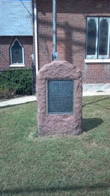
2. Finns Point Marker
Photographed by Keith S Smith, September 20, 2013
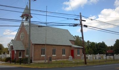
3. Finns Point Marker in St. Georges Church yard
Credits. This page was last revised on October 4, 2026. It was originally submitted on September 20, 2013, by Keith S Smith of West Chester, Pennsylvania. This page has been viewed 711 times since then and 39 times this year. Photos: 1, 2, 3. submitted on September 20, 2013, by Keith S Smith of West Chester, Pennsylvania. • Bill Pfingsten was the editor who published this page.
