Near Lowell in Benton County, Arkansas — The American South (West South Central)
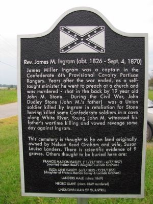
Rev. James M. Ingram
(abt. 1826 - Sept. 4, 1870)
James Miller Ingram was a captain in the Confederate 6th Provisional Cavalry Partisan Rangers. Years after the war ended, as a self-taught minister he went to preach at a church and was murdered - shot in the back by 19 year old John M. Stone. During the Civil War, John Dudley Stone (John M.'s father) was a Union soldier killed by Ingram in retaliation for Stone having killed some Confederate soldiers in a cave along the White River. Young John M. witnessed his father's wartime killing and vowed revenge some day against Ingram.
This cemetery is thought to be on land originally owned by Nelson Reed Graham and wife, Susan Louisa Landers. There is scientific evidence of 9 graves. Others thought to be buried here are:
Francis Marion Easley (11/22/1831 - 4/7/1857)
(married Nelson Reed's daughter, Lucinda Graham)
Eliza Jane Easley (4/8/1853 - 7/29/1855)
(daughter of Francis Marion Easley & Lucinda Graham)
Landers Male (circa. 1869)
Negro slave (circa. 1869 murdered)
Unknown Man of Quantrill
Topics. This historical marker is listed in these topic lists: Cemeteries & Burial Sites • War, US Civil. A significant historical year for this entry is 1869.
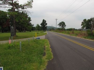
Location. 36° 13.883′ N, 94° 6.37′ W. Marker is near Lowell, Arkansas, in Benton County. Marker is at the intersection of Primrose Road and Phillips Road, on the left when traveling south on Primrose Road. Intersection is 0.5 miles north of Arkansas Highway 264. Touch for map. Marker is in this post office area: Lowell AR 72745, United States of America. Touch for directions.
Other nearby markers. At least 8 other markers are within 3 miles of this marker, measured as the crow flies. Fitzgerald's Station (approx. 1.8 miles away); Canning Factory (approx. 2.1 miles away); First Free Will Baptist Church (approx. 2.2 miles away); First Baptist Church (approx. 2.2 miles away); L. P. Davis House and Grounds (approx. 2.3 miles away); IOOF/Masonic Lodge Building (approx. 2.3 miles away); Train Depot (approx. 2.3 miles away); Lowell Postal Service (approx. 2.3 miles away). Touch for a list and map of all markers in Lowell.
Credits. This page was last revised on June 16, 2016. It was originally submitted on September 24, 2013, by Lee Hattabaugh of Capshaw, Alabama. This page has been viewed 941 times since then and 15 times this year. Photos: 1, 2. submitted on September 24, 2013, by Lee Hattabaugh of Capshaw, Alabama. • Bernard Fisher was the editor who published this page.

