Hixson in Hamilton County, Tennessee — The American South (East South Central)
Sherman Crosses the River
A Complex Operation
— Chattanooga Campaign —
After the Battle of Chickamauga in September 1863, Union Gen. William S. Rosecrans retreated to Federal-occupied Chattanooga, a strategically vital rail center, where Confederate Gen. Braxton Bragg laid siege from Lookout Mountain and Missionary Ridge, Union Gen. Ulysses S. Grant took command in October and began his efforts to break the siege. Bragg detached forces under Gen. James Longstreet to attack Knoxville as a diversion. After Gen. William T. Sherman reinforced Grant in November, the Federals attacked the heights and Bragg retreated. The Union army held the city for the rest of the war.
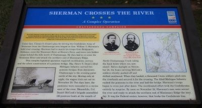
Union Gen. Ulysses S. Grant's plan for driving the Confederate Army of Tennessee from the Chattanooga area hinged on Gen. William T. Sherman's bold river crossing. Sherman had to march his troops from Bridgeport, Alabama, cross the Tennessee River at Brown's Ferry, and move into hidden camps behind the hills north of Chattanooga. He then had to re-cross the Tennessee River and attack the northern end of Missionary Ridge.
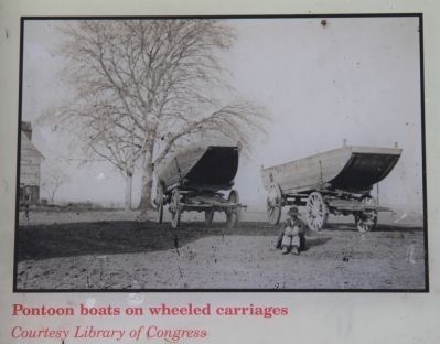
This complex logistical operation required coordination, secrecy, and the silent construction of a pontoon bridge. Maj. Henry S. Dean's 22nd Michigan Infantry carried two pontoon bridges from downtown Chattanooga to the crossing point north of the city. Moving only at night, the wagon train set out on November 20. Two days later, the pontoons were concealed in a ravine west of the river. Meanwhile, Col. Daniel McCook's brigade assembled 116 pontoon boats at the mouth of North Chattanooga Creek (along the bank below where you now stand). Before daylight on November 24, the boats carrying McCook's soldiers silently pushed off and drifted southward. When they landed, a thousand Union soldiers piled onto the riverbank and secured it for the crossing. The 22nd Michigan Infantry rushed the pontoons to the river and laid the bridge. Sherman's troops began to cross just after dawn. The coordinated effort took the Confederates entirely by surprise. By noon on November 24, Sherman's men were across the river and ready to attack the northern end of Missionary ridge the next day. It was the Federal center, however, that broke the Confederate line.
Erected by Tennessee Civil War Trails.
Topics. This historical marker is listed in these topic lists: War, US Civil • Waterways & Vessels. A significant historical month for this entry is September 1863.
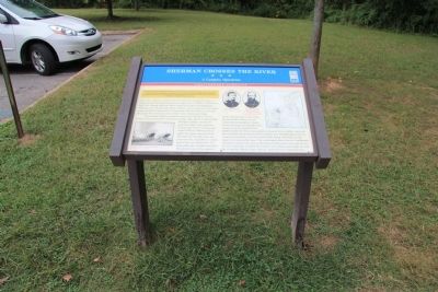
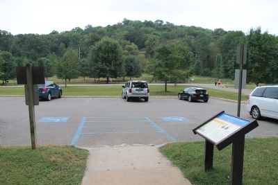
Location. 35° 7.605′ N, 85° 12.97′ W. Marker is in Hixson, Tennessee, in Hamilton County. Marker is on Gann Store Road south of Hamill Road. This historical marker is located in the North Chickamauga Creek Conservancy, off of one of the park's access roads
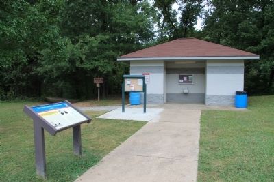
(labeled Gann Store Road on the Google map), across the street from the Greenway Farms Dog Park, between a parking lot and a restroom facility. Touch for map. Marker is in this post office area: Hixson TN 37343, United States of America. Touch for directions.
Other nearby markers. At least 8 other markers are within 4 miles of this marker, measured as the crow flies. Chickamauga Dam and Reservoir (approx. 1.9 miles away); Cincinnati Southern Railway Bridge (approx. 2 miles away); The Civilian Conservation Corps and Booker T. Washington State Park (approx. 2.4 miles away); Booker Taliaferro Washington (approx. 2.4 miles away); The Life of Booker Taliaferro Washington (approx. 2˝ miles away); The Tuskegee Institute (approx. 2.6 miles away); Cast Down Your Buckets (approx. 2.7 miles away); Roxbury Indian Mound (approx. 3.6 miles away).
More about this marker. Although it cannot be seen when standing by the historical marker, immediately to the west of the marker, concealed by the tree line and the nearby restroom facility, is the stream initially used by the Union forces as their assembly area for both troops and boats, North Chickamauga Creek.
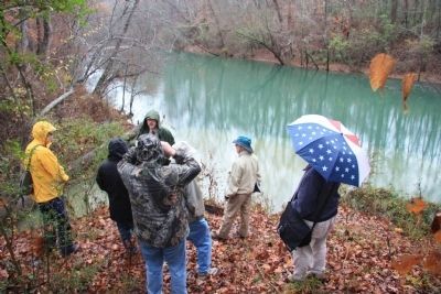
Regarding Sherman Crosses the River. On December 5, 6, & 7, of 2013, I went on a tour with the Blue & Gray Eduction Society, that was led by Jim Ogden of the National Park Service. He took us to the actual site, of where, on the
Photographed By Dale K. Benington, September 24, 2013
3. Sherman Crosses the River Marker
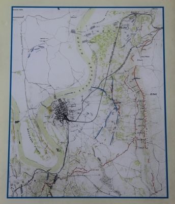
A close-up view of the map displayed on the historical marker showing the positions of both the Union and Confederate troops, in the Chattanooga area, at the start of the action, during the Battles for Chattanooga.
To get to this site we needed to cross the Tennessee River on northbound State Route 153, and look for a turnoff by some overhead power lines, a short distance beyond the Tennessee River. From this point there was a trail that led a short distance down to the creek. The coordinates for this site are 35.06.875 N by 085.13.736 W, and I have included a picture of this location.
In my opinion the location and wording of this marker is useful, but misleading, with regards to the actual location of the launching point of the Union landing operations.
Related markers. Click here for a list of markers that are related to this marker. To better understand the relationship, study each marker in the order shown.
Photographed By Dale K. Benington, December 6, 2013
8. Sherman Crosses the River
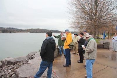
View from near where the Union forces landed on the south side of the Tennessee River, looking upstream, towards the launching point of the Union assault. This picture was taken from near the marker at 35.05.389 N by 085.16.037 W.
Credits. This page was last revised on February 7, 2023. It was originally submitted on September 27, 2013, by Dale K. Benington of Toledo, Ohio. This page has been viewed 1,273 times since then and 79 times this year. Photos: 1, 2, 3, 4, 5, 6. submitted on September 28, 2013, by Dale K. Benington of Toledo, Ohio. 7, 8. submitted on December 10, 2013, by Dale K. Benington of Toledo, Ohio.
