Marianna in Jackson County, Florida — The American South (South Atlantic)
St. Luke's Churchyard
Photographed by Tim Fillmon, August 1, 2013
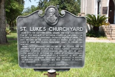
1. St. Luke's Churchyard Marker
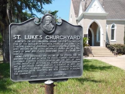
Among these individuals are: victims of the federal raid on Marianna in the War Between the States; Florida's Confederate Governor; a United States Senator; and the wife of John Gorrie, inventor of artificial ice. Others of extended renown are a nationally famous novelist, a scientist of note, and great educators known throughout the Southeast, in addition to numerous local dignitaries who were prominent in building the community.
Erected 1976 by Jackson County Historical Commission.
Topics. This historical marker is listed in these topic lists: Cemeteries & Burial Sites • Religion & Religious Structures. A significant historical year for this entry is 1838.
Location. 30° 46.536′ N, 85° 13.934′ W. Marker is in Marianna, Florida, in Jackson County. It is at the intersection of Lafayette Street (U.S. 90)
this page online

Regionally, this marker is on the Florida Panhandle. It is also in the American South and specifically in the Deep South. Globally, it is in the North Atlantic Region, North America, a Gulf of Mexico state, the Western Hemisphere, the Western World, and the Anglosphere. Historically, it finds itself in what was once New Spain, the territory of the Mississippian Culture, one of the Confederate States of America, and the Antebellum South.
Other nearby markers. At least 8 other markers are within walking distance of this marker: Site of the Battle of Marianna (within shouting distance of this marker); The Holden House (within shouting distance of this marker); First United Methodist Church (approx. 0.2 miles away); Ely-Criglar House (approx. 0.2 miles away); The Woman's Club (approx. 0.2 miles away); Confederate Heroes (approx. 0.2 miles away); The West End Community (approx. 0.2 miles away); Fighting at Ely Corner
Photographed by Cosmos Mariner, May 24, 2013
2. St. Luke's Churchyard Marker
Related marker. Click here for another marker that is related to this marker. Also at the St. Luke's Churchyard.
Also see . . . St Luke's Episcopal Church. Website homepage (Submitted on August 9, 2026, by Larry Gertner of New York, New York.)
Photographed by Tim Fillmon, August 1, 2013
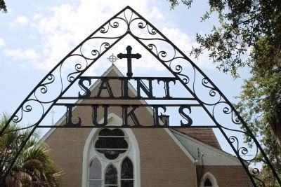
3. St. Luke's Churchyard Entrance
Photographed by Tim Fillmon, August 1, 2013
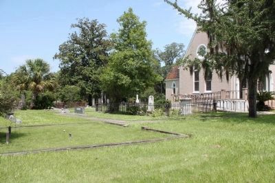
4. St. Luke's Churchyard
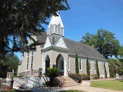
Photographed by Cosmos Mariner, May 24, 2013
5. St. Luke's Episcopal Church
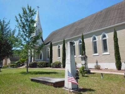
Photographed by Cosmos Mariner, May 24, 2013
6. Grave of Jesse Robinson (1789-1854), a War of 1812 veteran
Another grave can also be seen in the background in this partial view of the church's cemetery.
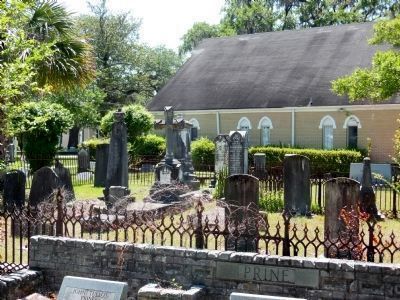
Photographed by Cosmos Mariner, May 24, 2013
7. St. Luke's Churchyard Cemetery
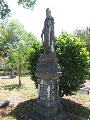
Photographed by Cosmos Mariner, May 24, 2013
8. Hattie Walker Butler Memorial
St. Luke's Churchyard Cemetery
Credits. This page was last revised on August 9, 2026. It was originally submitted on August 12, 2013, by Tim Fillmon of Webster, Florida. This page has been viewed 1,004 times since then and 34 times this year. Last updated on September 28, 2013, by Cosmos Mariner of Cape Canaveral, Florida. Photos: 1. submitted on August 12, 2013, by Tim Fillmon of Webster, Florida. 2. submitted on September 24, 2013, by Cosmos Mariner of Cape Canaveral, Florida. 3, 4. submitted on August 12, 2013, by Tim Fillmon of Webster, Florida. 5, 6, 7, 8. submitted on September 24, 2013, by Cosmos Mariner of Cape Canaveral, Florida. • Bill Pfingsten was the editor who published this page.
