Near Lookout Mountain in Hamilton County, Tennessee — The American South (East South Central)
Walthall's Brigade
Cheatham's Division
— Hardee's Corps. —
Inscription.
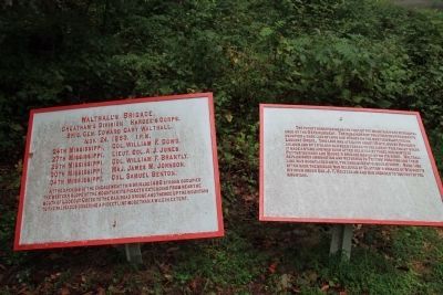
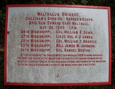
[Text from the First Tablet]:
Cheatham's Division - Hardee's Corps.
Brig. Gen. Edward Cary Walthall.
Nov. 24, 1863, 1 p.m.
24th Mississippi - Col. William F. Dowd.
27th Mississippi - Lieut. Col. A. J. Jones.
29th Mississippi - Col. William Brantly.
30th Mississippi - Maj. James M. Johnson.
34th Mississippi - Col. Samuel Benton.
At the opening of the engagement this brigade 1489 strong occupied the western slope of the mountain its pickets extending from near the mouth of Lookout Creek to the railroad bridge and thence up the mountain to the palisades covering a picket line more than a mile in extent.
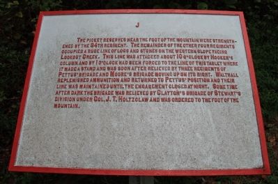
[Text from the Second Tablet]:
The picket reserves near the foot of the mountain were strengthened by the 34th Regiment. The remainder of the other four regiments occupied a rude line of logs and stones on the western slope facing Lookout Creek. This line was attacked about 10 o'clock by Hooker's column and by 1 o'clock had been forced to the line of this tablet where it made a stand and was soon after relieved by three regiments of Pettus' Brigade and Moore's Brigade moving up on its right. Walthall replenished ammunition and returned to Pettus' position and their line was maintained until the engagement closed at night. Some time after dark the brigade was relieved by Clayton's Brigade of Stewart's Division under Col. J.T. Holtzclaw and was ordered to the foot of the mountain.
Erected 1890 by the Chickamauga and Chattanooga National Military Park Commission. (Marker Number MT-391-92.)
Topics and series. This historical marker is listed in this topic list: War, US Civil. In addition, it is included in the Chickamauga and Chattanooga National Military Park, Lookout Mountain, and the Chickamauga and Chattanooga National Military Park: November 24, 1863 series lists. A significant historical date for this entry is November 24, 1863.
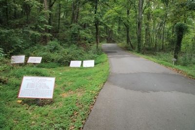
Location. 35° 0.65′ N, 85° 20.403′ W. Marker is near Lookout Mountain, Tennessee, in Hamilton County. Marker is on Shingle Road north of Lookout Mountain Scenic Highway (Route 148), on the left when traveling north. This historical marker is located in a cluster of Confederate historical tablets, situated in a heavily forested area, about midway between the Lookout Mountain Scenic Highway and the Cravens House. Touch for map. Marker is in this post office area: Lookout Mountain TN 37350, United States of America. Touch for directions.
Other nearby markers. At least 8 other markers are within walking distance of this marker. Pettus' Brigade (here, next to this marker); Final Line (a few steps from this marker); Clayton's Brigade (a few steps from this marker);
Stevenson's Division (within shouting distance of this marker); Moore's Brigade (within shouting distance of this marker); Incline Number One (about 400 feet away, measured in a direct line); Final Union Line (about 600 feet away); 2nd Ohio Infantry (about 600 feet away). Touch for a list and map of all markers in Lookout Mountain.
Credits. This page was last revised on July 15, 2017. It was originally submitted on September 28, 2013, by Dale K. Benington of Toledo, Ohio. This page has been viewed 635 times since then and 29 times this year. Photos: 1, 2, 3, 4. submitted on September 28, 2013, by Dale K. Benington of Toledo, Ohio.


