Near Charlotte in Dickson County, Tennessee — The American South (East South Central)
Promise Land

Photographed by Don Morfe, July 25, 2013
1. Promise Land Marker
Erected by Tennessee Historical Commission. (Marker Number 3E 17.)
Topics and series. This historical marker is listed in these topic lists: African Americans • Settlements & Settlers • War, US Civil. In addition, it is included in the Tennessee Historical Commission series list.
Location. 36° 12.646′ N, 87° 19.883′ W. Marker is near Charlotte, Tennessee, in Dickson County. It is on Promise Land Road 0.1 miles north of Reddon Crossing Road, on the left when traveling north. Touch for map. Marker is in this post office area: Charlotte TN 37036, United States of America. Touch for directions.

Regionally,
this page online
Other nearby markers. At least 8 other markers are within 4 miles of this marker, measured as the crow flies: Theodore Edmondson / Lizzie Vanleer Edmondson (within shouting distance of this marker); Promise Land School (within shouting distance of this marker); Fighting for Freedom (within shouting distance of this marker); Civil War In Charlotte (approx. 2.3 miles away); To All Who Served (approx. 2.3 miles away); Robert Nesbit (approx. 2.3 miles away); Hand House (approx. 4 miles away); Thompson House (approx. 4.1 miles away). Touch for a list and map of all markers in Charlotte.
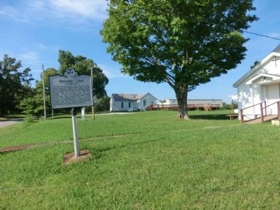
Photographed by Don Morfe, July 25, 2013
2. Promise Land Marker
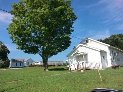
Photographed by Don Morfe, July 25, 2013
3. St. John Church
Credits. This page was last revised on January 20, 2020. It was originally submitted on October 2, 2013, by Don Morfe of Baltimore, Maryland. This page has been viewed 1,134 times since then and 45 times this year. Photos: 1, 2, 3. submitted on October 2, 2013, by Don Morfe of Baltimore, Maryland. • Bernard Fisher was the editor who published this page.
