Near Franklin in Williamson County, Tennessee — The American South (East South Central)
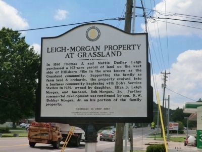
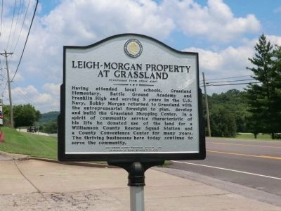
Leigh-Morgan Property at Grassland
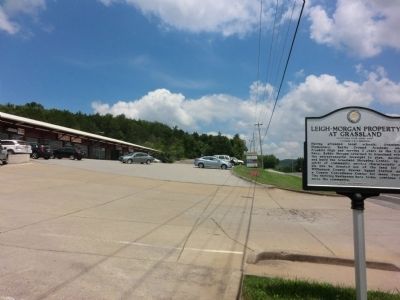
Having attended local schools, Grassland Elementary, Battle Ground Academy and Franklin High and serving 3 years in the U.S. Navy, Bobby Morgan returned to Grassland with the entrepreneurial foresight to plan, develop and build the Grassland Shopping Center. In a spirit of community service characteristic of his life he donated use of the land for a Williamson County Rescue Station and a County Convenience Center for many years. The thriving businesses here today continue to serve the community
Erected 2010 by Williamson County Historical Society in memory of Bobby Morgan 1929-2009.
Topics and series. This historical marker is listed in this topic list: Charity & Public Work. In addition, it is included in the Tennessee – Williamson County Historical Society series list. A significant historical year for this entry is 1898.
Location. 35° 59.886′ N, 86° 53.184′ W. Marker is near Franklin, Tennessee, in Williamson County. Marker is on Hillsboro Road (U.S. 431) 0.1 miles south of J B Hood Drive, on the right when traveling south. Touch for map. Marker is in this post office area: Franklin TN 37069, United States of America. Touch for directions.
Other nearby markers. At least 8 other markers are within 2 miles of this marker, measured as the crow flies. Montpier (approx. 0.6 miles away); Grassland Community (approx. 0.9 miles away); Berry’s Chapel Stone Wall / Berry's Chapel Community (approx. 1.3 miles away); Berry’s Chapel Church of Christ (approx. 1.4 miles away); Samuel Claybrook Locke (approx. 1.4 miles away); Motheral/Moran House (approx. 1˝ miles away); Motheral-Ring Family of Locust Guard (approx. 1.6 miles away); James McGavock Family Cemetery (approx. 1.9 miles away). Touch for a list and map of all markers in Franklin.
Credits. This page was last revised on March 6, 2022. It was originally submitted on October 4, 2013, by Don Morfe of Baltimore, Maryland. This page has been viewed 651 times since then and 18 times this year. Photos: 1, 2, 3. submitted on October 4, 2013, by Don Morfe of Baltimore, Maryland. • Al Wolf was the editor who published this page.


