Near Echo in Yellow Medicine County, Minnesota — The American Midwest (Upper Plains)
The Wood Lake Battle
Photographed by K. Linzmeier, September 25, 2013
1. The Wood Lake Battle Marker
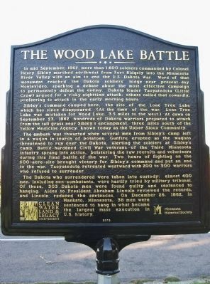
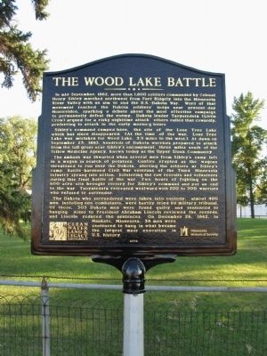
Sibley’s command camped here, the site of the Lone Tree Lake which has since disappeared. (At the time of the war, Lone Tree Lake was mistaken for Wood Lake, 3.5 miles to the west.) At dawn on September 23, 1862, hundreds of Dakota warriors prepared to attack from the tall grass near Sibley’s encampment, three miles south of the Yellow Medicine Agency, known today as the Upper Sioux Community.
The ambush was thwarted when several men from Sibley’s camp left in a wagon in search of potatoes. Gunfire erupted as the wagons threatened to run over the Dakota, alerting the soldiers at Sibley’s camp. Battle-hardened
this page online
The Dakota who surrendered were taken into custody; almost 400 men, including non-combatants, were hastily tried by military tribunal. Of those, 303 Dakota men were found guilty and sentenced to hanging. Aides to President Abraham Lincoln reviewed the records, and Lincoln reduced the sentences. On December 26, 1862, in Mankato, Minnesota, 38 men were sentenced to hang in what became the largest mass execution in U.S. history.
Minnesota Historical Society
2012
Erected 2012 by the Minnesota Historical Society, funding by the Clean Water, Land and Legacy Amendment.
Topics and series. This historical marker is listed in this topic list: Wars, US Indian. In addition, it is included in the Minnesota Historical Society series list. A significant historical month for this entry is September 1940.
Location. 44° 42.092′ N,
Photographed by K. Linzmeier, September 25, 2013
2. The Wood Lake Battle Marker

Regionally, this marker is in Southwest Minnesota and specifically in the Minnesota River Valley. It is also in the American Midwest, in the Corn Belt, and on the Great Plains. Globally, it is in North America, the Western Hemisphere, the Western World, and the Anglosphere. Historically, it finds itself in what was once Rupert’s Land, the territory of the Mississippian Culture, and the Louisiana Purchase.
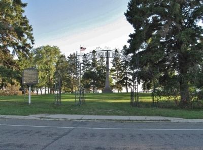
Other nearby markers. At least 8 other markers are within 3 miles of this marker, measured as the crow flies: Wood Lake Battlefield State Monument (within shouting distance of this marker); Mazomani (approx. 2.1 miles away); Upper (Or Yellow Medicine) Sioux Agency (approx. 2.4 miles away); The Annuity Center/Warehouse (approx. 2.4 miles away); Upper Sioux Agency (approx. 2.4 miles away); Employee Duplex No. 1
Photographed by K. Linzmeier, September 25, 2013
3. The Wood Lake Battle Marker
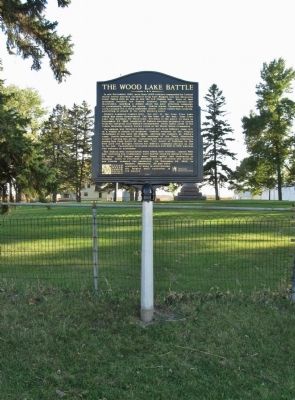
More about this marker. A previous marker erected in 1995 with outdated language was replaced with this marker in 2012. The content of the new sign was reviewed by a Minnesota Historical Society historical marker committee, as well as by Dakota consultants and the Minnesota Historical Society Indian Advisory Committee.
Also see . . .
1. Battle of Wood Lake, September 23, 1862. MNopedia website entry (Submitted on December 2, 2025, by Larry Gertner of New York, New York.)
2. The US-Dakota War of 1862. Minnesota Historical Society website entry (Submitted on October 6, 2013.)
Photographed by K. Linzmeier, September 25, 2013
4. The Wood Lake Battle Marker
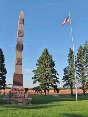
Photographed by K. Linzmeier, September 25, 2013
5. Nearby Monument and Flag
Credits. This page was last revised on December 2, 2025. It was originally submitted on October 6, 2013, by Keith L of Wisconsin Rapids, Wisconsin. This page has been viewed 1,231 times since then and 50 times this year. Photos: 1, 2, 3, 4, 5. submitted on October 6, 2013, by Keith L of Wisconsin Rapids, Wisconsin.
