San Marcos in Hays County, Texas — The American South (West South Central)
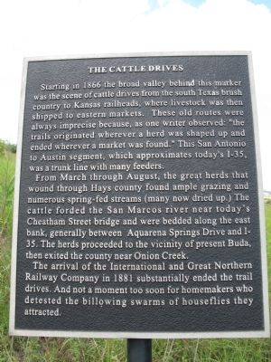
The Cattle Drives
From March through August, the great herds that wound through Hays County found ample grazing and numerous spring-fed streams (many now dried up.) The cattle forded the San Marcos river near today’s Cheatham Street bridge and were bedded along the east bank, generally between Aquarena Springs Drive and I-35. The herds proceeded to the vicinity of present Buda, then exited the county near Onion Creek.
The arrival of the International and Great Northern Railway Company in 1881 substantially ended the trail drives. And not a moment too soon for homemakers who detested the billowing swarms of houseflies they attracted.
Topics. This historical marker is listed in these topic lists: Animals • Railroads & Streetcars • Roads & Vehicles • Settlements & Settlers. A significant historical year for this entry is 1866.
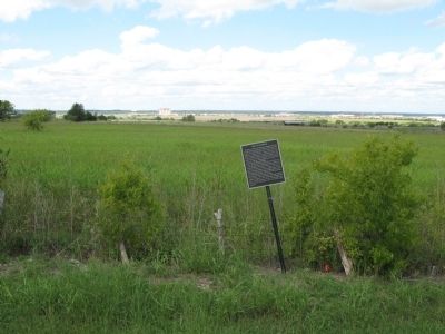
Location. 29° 49.478′ N, 97° 57.059′ W. Marker is in San Marcos, Texas, in Hays County. Marker is at the intersection of South Old Bastrop Road (County Route 266) and East McCarty Lane (County Route 233), on the right when traveling south on South Old Bastrop Road. Marker is located across from San Macros High School on Old Bastrop Road (also known as the Camino Real). Touch for map. Marker is at or near this postal address: 2601 E McCarty Ln, San Marcos TX 78666, United States of America. Touch for directions.
Other nearby markers. At least 8 other markers are within 4 miles of this marker, measured as the crow flies. Kings Highway (approx. 1.3 miles away); Pitts Cemetery (approx. 2˝ miles away); First Baptist Church (approx. 2.6 miles away); a different marker also named Kings Highway (approx. 2.6 miles away); Redwood Cemetery (approx. 2.9 miles away); Thompson's Islands (approx. 3.4 miles away); First Baptist Church NBC of San Marcos (approx. 3.4 miles away); Belvin Street Historic District (approx. 3˝ miles away). Touch for a list and map of all markers in San Marcos.
Additional keywords. El Camino Real
Credits. This page was last revised on June 16, 2016. It was originally submitted on October 7, 2013, by Richard Denney of Austin, Texas. This page has been viewed 667 times since then and 29 times this year. Photos: 1, 2, 3. submitted on October 7, 2013, by Richard Denney of Austin, Texas. • Bernard Fisher was the editor who published this page.


