San Marcos in Hays County, Texas — The American South (West South Central)
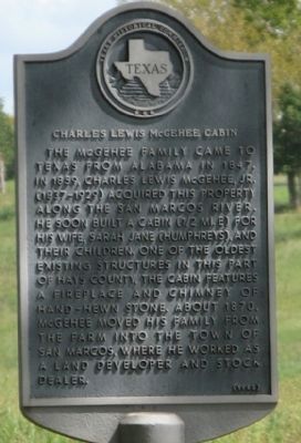
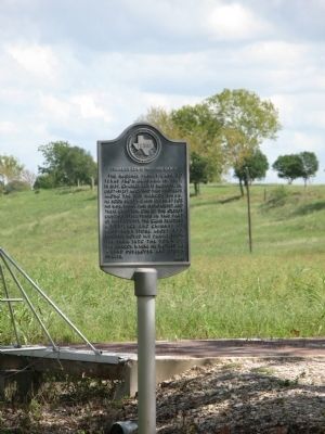
Charles Lewis McGehee Cabin
Erected 1985 by Texas Historical Commission. (Marker Number 10294.)
Topics. This historical marker is listed in these topic lists: Roads & Vehicles • Settlements & Settlers. A significant historical year for this entry is 1847.
Location. 29° 51.329′ N, 97° 53.891′ W. Marker is in San Marcos, Texas, in Hays County. Marker is on North Old Bastrop Highway (County Route 266) 1.3 miles south of San Marcos Highway (Texas Highway 80), on the left when traveling south. Marker is just within the gate of private property on Rancho De Camino Real - Railroad Road south of the San Marcos River. Touch for map. Marker is in this post office area: San Marcos TX 78666, United States of America. Touch for directions.
Other nearby markers. At least 8 other markers are within 2 miles of this marker, measured as the crow flies. Site of the First Town of San Marcos (a few steps from this marker); Don Felipe Roque de la Portilla (a few steps from this marker); Lt. Zebulon M. Pike (within shouting distance of this marker); Col. Ignacio Elizondo’s 1813 Campaign (approx. ¼ mile away); McGehee Crossing (approx. 1.1 miles away); Cheatham-Hohenberg Cemetery (approx. 1.1 miles away); Kings Highway (approx. 1.3 miles away); Thompson's Islands (approx. 2.1 miles away). Touch for a list and map of all markers in San Marcos.
Credits. This page was last revised on June 16, 2016. It was originally submitted on October 7, 2013, by Richard Denney of Austin, Texas. This page has been viewed 726 times since then and 27 times this year. Photos: 1, 2, 3. submitted on October 7, 2013, by Richard Denney of Austin, Texas. • Bernard Fisher was the editor who published this page.


