Smyrna in Rutherford County, Tennessee — The American South (East South Central)
Outbuildings
Sam Davis Home
Photographed by Don Morfe, July 25, 2013
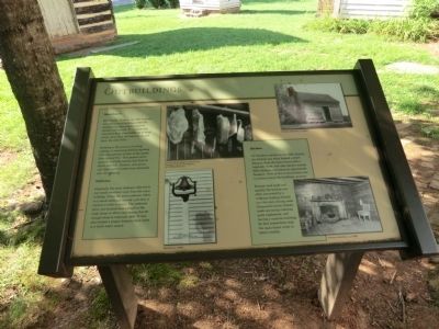
1. Outbuildings Marker
Smokehouse
Historically, farms in the 19th century included a small building called the smokehouse where meats could be smoked and stored. It was generally separated from other buildings to keep smoke away from the main house and lower the risk of fire.
Smoking is the process of curing, cooking, or seasoning food by exposing it for long periods of time to the smoke from a wooden fire. This process slows bacteria and kills insects that feed on meats and fish. Hickory, oak, pecan and other native woods were commonly used for smoking.
Outhouse
Originally the term outhouse referred to a small structure away from the main building. Today the term outhouse refers to a small enclosure around a pit that is used as a toilet or privy. The outhouse privy was located close enough to the main house to allow easy access, but far enough away to minimize odor. It was also located a proper distance from wells or fresh water source.
Kitchen
On Southern estates in the 19th century, the kitchen was often located a short distance from the main house with a vegetable, herb, and spice garden nearby. Most kitchens contained
this page online
Because food could cool quickly, the kitchen was often connected by a walkway leading directly into the main dining room. Tennessee’s warm climate made operating a kitchen quite unpleasant, and having a separate building for food preparation kept the main house cooler in hotter months.
(captions)
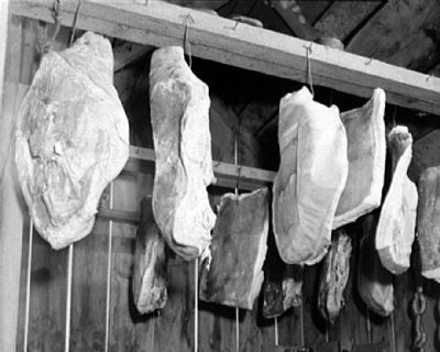
Cured pork hanging in meat house. Courtesy Library of Congress, LC-USF34-082115-C
Postcard ca. 1960s
Exterior of kitchen, a 1930s
Interior of kitchen, ca 1930s
Topics and series. This historical marker is listed in these topic lists: Agriculture • Settlements & Settlers. In addition, it is included in the If You've Got to Go... series list.
Location. 35° 59.383′ N, 86° 30.067′ W. Marker is in Smyrna, Tennessee, in Rutherford County. It can be reached from Sam Davis Road 0.3 miles west of Brookhaven Trail, on the right when traveling west. The marker is located on the grounds of the Sam Davis Home. Touch for map. Marker is at or near this postal address: 1399 Sam Davis Road, Smyrna
Photographed by Don Morfe, July 25, 2013
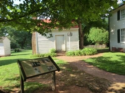
2. Outbuildings Marker

Regionally, this marker is in Middle Tennessee and in Greater Nashville. It is also in the American South and specifically in the Upper South. Globally, it is in North America, the Western Hemisphere, the Western World, and the Anglosphere. Historically, it finds itself in what was once the territory of the Mississippian Culture, one of the Confederate States of America, and the Antebellum South.
Other nearby markers. At least 8 other markers are within 2 miles of this marker, measured as the crow flies: Sam Davis Home (within shouting distance of this marker); Sam Davis Gravesite (within shouting distance of this marker); Slave Cabins (about 300 feet away, measured in a direct line); The Sam Davis Boyhood Home (about 400 feet away); a different marker also named Sam Davis Home (approx. 0.3 miles away); Wheeler's Raid around Rosecrans (approx. 0.6 miles away); Old Jefferson (approx. 0.6 miles away); Dewitt Smith Jobe (approx. 1.1 miles away). Touch for a list and map of all markers in Smyrna.
Also see . . . Sam Davis Home and Museum. (Submitted on October 8, 2013.)
Photographed by Don Morfe, July 25, 2013
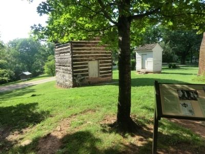
3. Outbuildings Marker
Photographed by John Collier, January 1942
4. Cured pork hanging in the meat house of a Negro FSA client at Calvert, Maryland
Library of Congress [LC-USF34-082115-C]
Credits. This page was last revised on February 3, 2020. It was originally submitted on October 7, 2013, by Don Morfe of Baltimore, Maryland. This page has been viewed 560 times since then and 12 times this year. Photos: 1, 2, 3. submitted on October 7, 2013, by Don Morfe of Baltimore, Maryland. 4. submitted on October 8, 2013. • Bernard Fisher was the editor who published this page.
