Near Sharpsburg in Washington County, Maryland — The American Northeast (Mid-Atlantic)
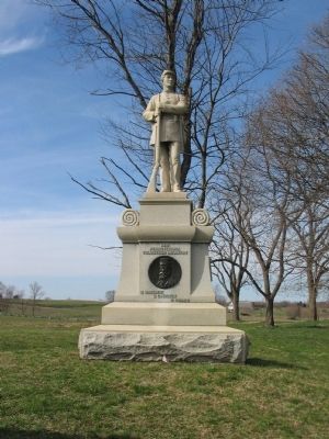
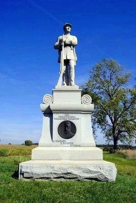
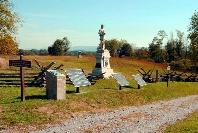
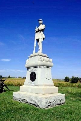
130th Pennsylvania Volunteer Infantry
Inscription.
(Front):
Pennsylvania
Vounteer
Infantry
2 Brigade
3 Division
2 Corps
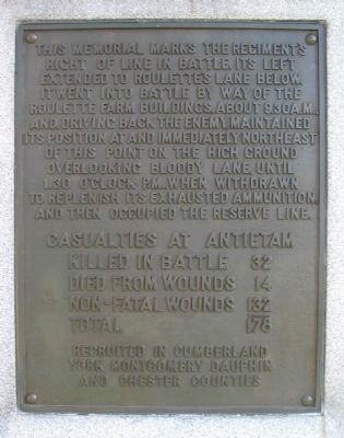
(Rear):
right of line in battle. Its left
extended to Roulette's Lane below.
It went into battle by way of the
Roulette Farm buildings about 9:30 a.m.
and, driving back the enemy, maintained
its position at and immediately northeast
of this point on the high ground
overlooking Bloody Lane, until
1:30 o'clock p.m., when withdrawn
to replenish its exhausted ammunition
and then occupied the reserve line.
Casualties at Antietam
Killed in battle 32
Died from wounds 14
Non-fatal wounds 132
Total 178
recruited in Cumberland
York Montgomery Dauphin
and Chester Counties
Erected 1904 by Commonwealth of Pennsylvania.
Topics. This historical marker is listed in this topic list: War, US Civil.
Location. 39° 28.288′ N, 77° 44.438′ W. Marker is near Sharpsburg, Maryland, in Washington County. Marker is on Richardson Avenue, on the left when traveling east. Located on the north end of Bloody Lane, near the pull parking area for stop eight, the Sunken Road, of Antietam Battlefield. Touch for map. Marker is in this post office area: Sharpsburg MD 21782, United States of America. Touch for directions.
Other nearby markers. At least 8 other markers are within walking distance of this marker. Second Army Corps (here, next to this marker); a different marker also named Second Army Corps (here, next to this marker); French's Division, Second Army Corps (a few steps from this marker); Jackson's Command (a few steps from this marker); 5th Maryland Infantry (a few steps from this marker); a different marker also named Second Army Corps (within shouting distance of this marker); Sixth Army Corps (within shouting distance of this marker); Fourteenth Connecticut Volunteer Infantry (within shouting distance of this marker). Touch for a list and map of all markers in Sharpsburg.
Also see . . .
1. 130th Pennsylvania Volunteer Infantry Monument. National Park Service page detailing the monument. (Submitted on April 5, 2008, by Craig Swain of Leesburg, Virginia.)
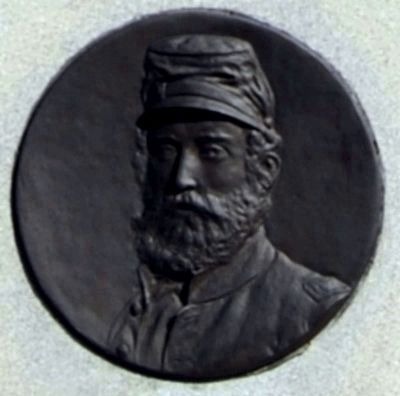
2. Henry I. Zinn (1834-1862). Find A Grave website entry:
He led his men at the September 17, 1862 Battle of Antietam, Maryland, where the unit lost 178 men killed, wounded and missing while fighting on the north side of the infamous Bloody Lane. (Submitted on September 27, 2015, by Brian Scott of Anderson, South Carolina.)
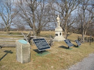
Photographed By Craig Swain, February 9, 2008
5. Monuments and Markers on the Northern End of the Sunken Road
From left to right: The 5th Maryland Infantry Monument, French's Division Tablet (Number 40), Weber's Brigade Tablet (Number 43), Morris' Brigade Tablet (Number 42), and the 130th Pennsylvania Infantry Monument.
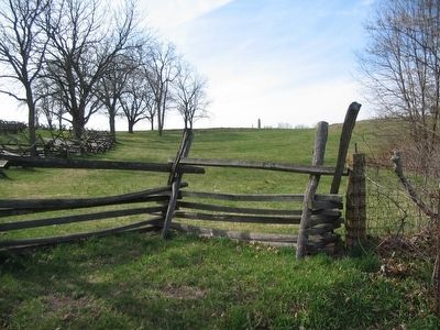
Photographed By Craig Swain, March 29, 2008
7. 130th Pennsylvania Advance toward the Sunken Road
From the Roulette Lane looking northwest. To the left is the Sunken Road. The 130th's monument can be seen between the trees along the lane. The shaft in the distance is the 14th Connecticut Infantry Monument. As Morris's Brigade advanced in line, the 14th was on the right of the 130th. The 130th's left flank dressed near the Roulette Lane. The 108th New York advanced on the other side of the lane, to the 130th's left. The regiments pressed toward the Confederate defensive position in the road bed, but was unable to reach the fence. Instead, the 130th held a position on the high ground to the right until relieved.
Credits. This page was last revised on May 24, 2023. It was originally submitted on April 5, 2008, by Craig Swain of Leesburg, Virginia. This page has been viewed 1,427 times since then and 11 times this year. Photos: 1, 2. submitted on April 5, 2008, by Craig Swain of Leesburg, Virginia. 3, 4. submitted on September 27, 2015, by Brian Scott of Anderson, South Carolina. 5. submitted on April 5, 2008, by Craig Swain of Leesburg, Virginia. 6. submitted on September 27, 2015, by Brian Scott of Anderson, South Carolina. 7. submitted on April 5, 2008, by Craig Swain of Leesburg, Virginia. 8. submitted on September 27, 2015, by Brian Scott of Anderson, South Carolina.
