Osawatomie in Miami County, Kansas — The American Midwest (Upper Plains)
Battle of Osawatomie
Photographed by William Fischer, Jr., August 31, 2013
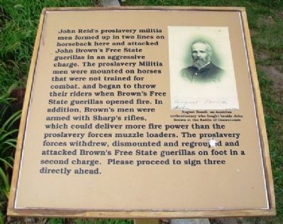
1. Battle of Osawatomie Marker
John Reid's proslavery militia men formed up in two lines on horseback here and attacked John Brown's Free State guerillas in an aggressive charge. The proslavery Militia men were mounted on horses that were not trained for combat, and began to throw their riders when Brown's Free State guerillas opened fire. In addition, Brown's men were armed with Sharp's rifles, which could deliver more fire power than the proslavery forces muzzle loaders. The proslavery forces withdrew, dismounted and regrouped and attacked Brown's Free State guerillas on foot in a second charge. Please proceed to sign three directly ahead.
[Photo caption reads] August Bondi, an Austrian revolutionary [sic] who fought beside John Brown at the Battle of Osawatomie.
Erected 2012 by Kansas State Historical Society. (Marker Number 2.)
Topics. This historical marker is listed in this topic list: Notable Events.
Location. 38° 29.938′ N, 94° 57.552′ W. Marker is in Osawatomie, Kansas, in Miami County. It can be reached from Main Street. Marker is about 75 feet northeast of the Adair Cabin, the centerpiece
this page online

Regionally, this marker is in Eastern Kansas, specifically in Bleeding Kansas Border War Country, and in Greater Kansas City. It is also in the American Midwest, in the Corn Belt, on the prairies, on the Southern Plains, and on the Santa Fe Trail Corridor. Globally, it is in North America, the Western Hemisphere, the Western World, and the Anglosphere. Historically, it finds itself in what was once the Louisiana Purchase.
Other nearby markers. At least 8 other markers are within walking distance of this marker: A different marker also named Battle of Osawatomie (within shouting distance of this marker); T. B. Williams and J. B. Remington (within shouting distance of this marker); John Brown Statue (within shouting distance of this marker); a different marker also named Battle of Osawatomie (within shouting distance of this marker); John Brown Battleground (within shouting distance
Photographed by William Fischer, Jr., August 31, 2013
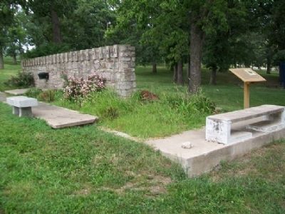
2. Battle of Osawatomie Marker
Also see . . .
1. John Brown Museum State Historic Site. Kansas Historical Society website entry (Submitted on October 10, 2013, by William Fischer, Jr. of Reynoldsburg, Ohio.)
2. Battle of Osawatomie Primary Documents. Internet Archive Wayback Machine website entry (Submitted on October 10, 2013, by William Fischer, Jr. of Reynoldsburg, Ohio.)
Credits. This page was last revised on April 9, 2025. It was originally submitted on October 10, 2013, by William Fischer, Jr. of Reynoldsburg, Ohio. This page has been viewed 640 times since then and 22 times this year. Photos: 1, 2. submitted on October 10, 2013, by William Fischer, Jr. of Reynoldsburg, Ohio.
