Osawatomie in Miami County, Kansas — The American Midwest (Upper Plains)
Battle of Osawatomie
Photographed by William Fischer, Jr., August 31, 2013
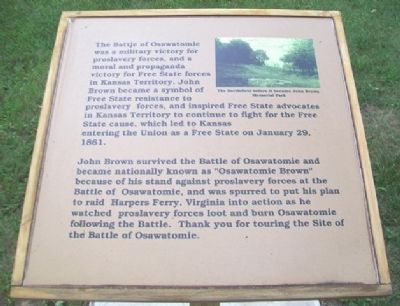
1. Battle of Osawatomie Marker
The Battle of Osawatomie was a military victory for proslavery forces, and a moral and propaganda victory for Free State forces in Kansas Territory. John Brown became a symbol of Free State resistance to proslavery forces, and inspired Free State advocates in Kansas Territory to continue to fight for the Free State cause, which led to Kansas entering the Union as a Free State on January 29, 1861.
John Brown survived the Battle of Osawatomie and became nationally known as "Osawatomie Brown" because of his stand against proslavery forces at the Battle of Osawatomie, and was spurred to put his plan to raid Harpers Ferry, Virginia into action as he watched proslavery forces loot and burn Osawatomie following the Battle. Thank you for touring the Site of the Battle of Osawatomie.
Erected 2012 by Kansas State Historical Society. (Marker Number 5.)
Topics. This historical marker is listed in this topic list: Notable Events. A significant historical month for this entry is January 1906.
Location. 38° 30.022′ N, 94° 57.561′ W. Marker is in Osawatomie, Kansas, in Miami County. It can be reached from John Brown State Park. Marker is
this page online

Regionally, this marker is in Eastern Kansas, specifically in Bleeding Kansas Border War Country, and in Greater Kansas City. It is also in the American Midwest, in the Corn Belt, on the prairies, on the Southern Plains, and on the Santa Fe Trail Corridor. Globally, it is in North America, the Western Hemisphere, the Western World, and the Anglosphere. Historically, it finds itself in what was once the Louisiana Purchase.
Other nearby markers. At least 8 other markers are within walking distance of this marker: A different marker also named Battle of Osawatomie (a few steps from this marker); a different marker also named Battle of Osawatomie (about 300 feet away, measured in a direct line); a different marker also named Battle of Osawatomie (about 500 feet away); a different marker also named Battle of Osawatomie (about 600
Photographed by William Fischer, Jr., August 31, 2013
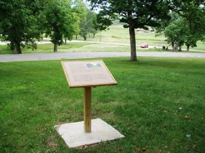
2. Battle of Osawatomie Marker
Also see . . .
1. John Brown Museum State Historic Site. Kansas Historical Society website entry (Submitted on October 11, 2013, by William Fischer, Jr. of Reynoldsburg, Ohio.)
2. Battle of Osawatomie Primary Documents. Internet Archive Wayback Machine website entry (Submitted on October 11, 2013, by William Fischer, Jr. of Reynoldsburg, Ohio.)
Credits. This page was last revised on April 11, 2025. It was originally submitted on October 11, 2013, by William Fischer, Jr. of Reynoldsburg, Ohio. This page has been viewed 640 times since then and 25 times this year. Photos: 1, 2. submitted on October 11, 2013, by William Fischer, Jr. of Reynoldsburg, Ohio.
