Cleveland in Bradley County, Tennessee — The American South (East South Central)
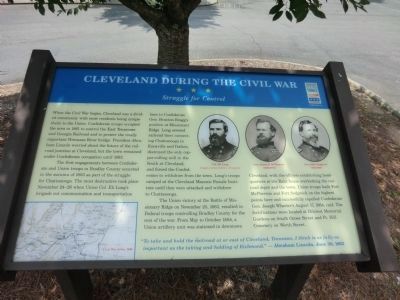
Cleveland During the Civil War
Struggle for Control
The first engagements between Confederate and Union troops in Bradley County occurred in the autumn of 1863 as part of the struggle for Chattanooga. The most destructive took place November 24-26 when Union Col. Eli Long’s brigade cut communications and transportation lines to Confederate Gen. Braxton Bragg’s position at Missionary Ridge. Long severed railroad lines connecting Chattanooga to Knoxville and Dalton, destroyed the only copper-rolling mill in the South at Cleveland, and forced the Confederates to withdraw from the town. Long’s troops camped at the Cleveland Masonic Female Institute until they were attacked and withdrew to Chattanooga.
The Union victory at the Battle of Missionary Ridge on November 25, 1863, resulted in Federal troops controlling Bradley County for the rest of the war. From May to October 1864, a Union artillery unit was stationed in downtown. Cleveland, with the officers establishing headquarter at the Raht house overlooking the railroad depot and the town. Union troops built Fort McPherson and Fort Sedgwick on the highest points here and successfully repelled Confederate Gen. Joseph Wheeler’s August 17, 1864, raid. The fortifications were located at Hilcrest Memorial Gardens on South Ocoee Street and Ft. Hill Cemetery on Worth Street.
“To take and hold the railroad at or east of Cleveland, Tennessee, I think is as fully as important as the taking and holding of Richmond.” —Abraham Lincoln, June 30, 1862
(captions)
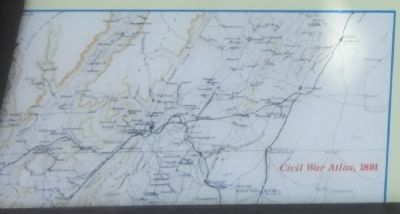
Civil War Atlas, 1891
Col. Eli Long
Gen. James B. McPherson (1828-1864
Gen. John Sedgwick (1813-1864)
Images courtesy Library of Congress
Erected by Tennessee Civil War Trails.
Topics and series. This historical marker is listed in this topic list: War, US Civil. In addition, it is included in the Former U.S. Presidents: #16 Abraham Lincoln, and the Tennessee Civil War Trails series lists. A significant historical date for this entry is June 30, 1861.
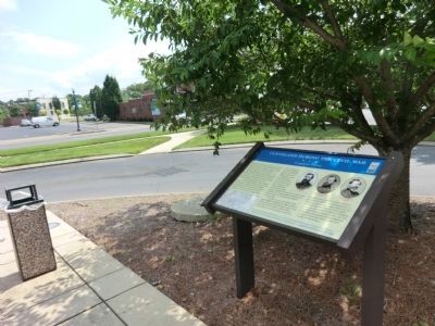
Location. 35° 9.47′ N, 84° 52.426′ W. Marker is in Cleveland, Tennessee, in Bradley County. Marker is at the intersection of Inman Street East (U.S. 64) and Parker Street Northeast, on the right when traveling east on Inman Street East. The marker is located at the Museum Center at Five Points. Touch for map. Marker is at or near this postal address: 200 Inman Street East, Cleveland TN 37311, United States of America. Touch for directions.
Other nearby markers. At least 8 other markers are within walking distance of this marker. Col. Benjamin Cleveland (about 400 feet away, measured in a direct line); Cleveland Southern Railway Depot (about 400 feet away); Historic Bohemia Theatre (approx. 0.2 miles away); Sousa and his Band (approx. 0.2 miles away); Bradley County World War II Memorial (approx. 0.2 miles away); Bradley County World War I Memorial (approx. 0.2 miles away); Bradley County Veterans Memorial (approx. 0.2 miles away); Bradley County Courthouse Meleeny Bell (approx. 0.2 miles away). Touch for a list and map of all markers in Cleveland.
Credits. This page was last revised on June 16, 2016. It was originally submitted on October 14, 2013, by Don Morfe of Baltimore, Maryland. This page has been viewed 1,660 times since then and 86 times this year. Photos: 1, 2, 3, 4, 5. submitted on October 14, 2013, by Don Morfe of Baltimore, Maryland. • Bernard Fisher was the editor who published this page.
