Quindaro Bluffs in Kansas City in Wyandotte County, Kansas — The American Midwest (Upper Plains)
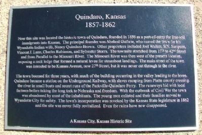
Quindaro, Kansas
1857 1862
— A Kansas City, Kansas Historic Site —
Near this site was located the historic town of Quindaro, founded in 1856 as a port-of-entry for free-soil immigrants into Kansas. The principal founder was Abelard Guthrie, who named the town for his Wyandotte Indian wife, Nancy Quindaro Brown. Other proprietors included Joel Walker, S.N. Simpson, Vincent J. Lane, Charles Robinson, and Sylvester Storrs. The townsite stretched from 17th [Street] to 42nd Street and from Parallel [Parkway] to the Missouri River. The Missouri River was then west of the present location, exposing a rock ledge that formed a natural levee for steamboat landings. The main street of the town was intended to be Kansas Avenue, now 27th Street, but it was never cut through to the river.
The town boomed for three years, with much of the building occurring in the valley leading to the levee. Quindaro became a station on the Underground Railway, with slaves escaping from Platte county crossing the river in small boats and secret runs of the Parkville-Quindaro Ferry. The runaways hid with local farmers before taking the long trek to Nebraska and freedom. With the outbreak of the Civil War the town was abandoned by most of the inhabitants. The young men enlisted and their families moved to Wyandotte City for safety. The town's incorporation was revoked by the Kansas State legislature in 1862 and the site was never fully revitalized. Even the ruins have now disappeared.
Topics. This historical marker is listed in these topic lists: Abolition & Underground RR • African Americans • Settlements & Settlers. A significant historical year for this entry is 1856.
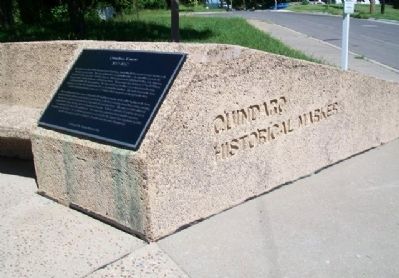
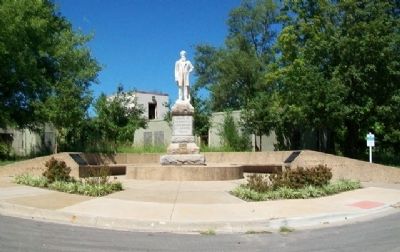
Location. 39° 8.944′ N, 94° 39.554′ W. Marker is in Kansas City, Kansas, in Wyandotte County. It is in Quindaro Bluffs. Marker is at the intersection of 27th Street and Sewell Avenue, on the left when traveling north on 27th Street. Touch for map. Marker is in this post office area: Kansas City KS 66104, United States of America. Touch for directions.
Other nearby markers. At least 8 other markers are within 3 miles of this marker, measured as the crow flies. John Brown (here, next to this marker); Western University (a few steps from this marker); Quindaro Ruins Archaeological Park (approx. 0.2 miles away); Mather Hall - Kansas City University (approx. 1˝ miles away); Eliza Burton Conley (approx. 3 miles away); Helena Conley (approx. 3 miles away); Silas Armstrong (approx. 3 miles away); The History of the Wyandot Indian Nation (approx. 3 miles away). Touch for a list and map of all markers in Kansas City.
Also see . . .
1. Quindaro, Kansas. Kansapedia website entry (Submitted on October 17, 2013, by William Fischer, Jr. of Scranton, Pennsylvania.)
2. "Annals of Quindaro: A Kansas Ghost Town" (Farley, 1956). Kansas Historical Society website entry (Submitted on October 17, 2013, by William Fischer, Jr. of Scranton, Pennsylvania.)
3. Quindaro & Western University Ruins, Kansas. Kansas Travel website entry (Submitted on October 17, 2013, by William Fischer, Jr. of Scranton, Pennsylvania.)
Credits. This page was last revised on February 10, 2023. It was originally submitted on October 17, 2013, by William Fischer, Jr. of Scranton, Pennsylvania. This page has been viewed 760 times since then and 28 times this year. Photos: 1, 2, 3. submitted on October 17, 2013, by William Fischer, Jr. of Scranton, Pennsylvania.


