Near Gardnerville in Douglas County, Nevada — The American Mountains (Southwest)
Double Springs
Photographed by Bruce Armbrust, October 13, 2013
1. Nevada SHM #126: Double Springs
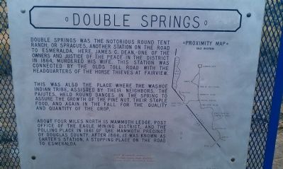
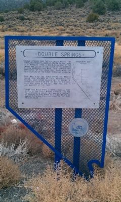
This was also the place where the Washoe Indian tribe, assisted by their neighbors, the Paiutes, held round dances in the spring to assure the growth of the pine nut, their staple food, and again in the fall for the quality and quantity of the crop.
About four miles north is Mammoth Ledge, post office of the Eagle Mining District, and the polling place in 1861 of the Mammoth precinct of Douglas County. After 1866, it was known as Carter's Station, a stopping place on the road to Esmeralda.
Erected by Nevada State Park System and the Carson Valley Historical Society. (Marker Number 126.)
Topics. This historical marker is listed in these topic lists: Indigenous Peoples and Communities • Settlements & Settlers. A significant historical year for this entry is 1864.
Location. 38° 47.615′ N, 119° 35.969′ W.
this page online

Regionally, this marker is in the Sierra Nevada, in the Lake Tahoe Basin, and in the Greater Reno Area. It is also in the American Mountain West. Globally, it is in North America, the Western Hemisphere, the Western World, and the Anglosphere. Historically, it finds itself in what was once New Spain and also Mexico’s Alta California.
Other nearby markers. At least 8 other markers are within 12 miles of this marker, measured as the crow flies: Snowshoe Thompson Home (approx. 9.4 miles away in California); Snowshoe Thompson (approx. 9.4 miles away in California); Snowshoe Thomson (approx. 9½ miles away in California); Twelve Mile House (approx. 9½ miles away); Dresslerville (approx. 9.6 miles away); Hangman’s Bridge Vigilante Justice (approx. 11½ miles away in California); Jacob Markley (approx. 11.9 miles away in California); Alpine County Courthouse (approx.
Photographed by Bruce Armbrust, October 13, 2013
2. Nevada SHM #126- Double Springs
Also see . . . New Amended Text for Marker. The Nevada State Historic Preservation Office (SHPO) recently updated the text of the roughly 260 state historical markers in Nevada. The Nevada SHPO placed the amended text of each individual marker on its website and will change the actual markers in the field as funding allows. Minor changes have been made to this marker for grammar and readability, and major changes have been made to content. The information on Native Americans has been removed. The link will take you to the Nevada SHPO page for the marker with the amended text. (Submitted on October 25, 2013, by Duane Hall of Abilene, Texas.)
Photographed by Jeff Leichsenring, July 2, 2024
3. Double Springs Marker
Credits. This page was last revised on July 23, 2024. It was originally submitted on October 18, 2013, by Bruce Armbrust of Carson City, Nevada. This page has been viewed 1,130 times since then and 65 times this year. Photos: 1, 2. submitted on October 18, 2013, by Bruce Armbrust of Carson City, Nevada. 3. submitted on July 17, 2024, by Jeff Leichsenring of Garland, Texas. • Syd Whittle was the editor who published this page.
