Knoxville in Knox County, Tennessee — The American South (East South Central)
Longstreet's Headquarters
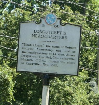
Photographed by Don Morfe, July 29, 2013
1. Longstreet's Headquarters Marker
Erected by Tennessee Historical Commission. (Marker Number 1E 66.)
Topics and series. This historical marker is listed in this topic list: War, US Civil. In addition, it is included in the Tennessee Historical Commission series list. A significant historical year for this entry is 1863.
Location. 35° 57.005′ N, 83° 57.376′ W. Marker is in Knoxville, Tennessee, in Knox County. It is on Kingston Pike (U.S. 70) 0.4 miles east of Cherokee Boulevard, on the right when traveling east. Touch for map. Marker is at or near this postal address: 3148 Kingston Pike, Knoxville TN 37919, United States of America. Touch for directions.

Regionally, this marker is in East Tennessee. It is also in the American South, specifically in the Upper South, in Appalachia, and specifically in Southern Appalachia. Globally, it is in North America, the Western Hemisphere, the Western World, and the Anglosphere. Historically, it finds itself
this page online
Other nearby markers. At least 8 other markers are within 2 miles of this marker, measured as the crow flies: Bleak House (within shouting distance of this marker); Votes for Women (approx. 0.7 miles away); War Dog Memorial (approx. 0.9 miles away); Sutherland Avenue McGhee Tyson Airport (approx. 0.9 miles away); 2111 Terrace Avenue (approx. one mile away); Medal of Honor Recipients (approx. 1.2 miles away); Confederate States of America Camp Van Dorn (approx. 1.3 miles away); UT RecSports Complex (approx. 1.4 miles away). Touch for a list and map of all markers in Knoxville.
Another marker is no longer nearby. Death of Gen. William P. Sanders (was approx. 0.4 miles away but has been confirmed missing).
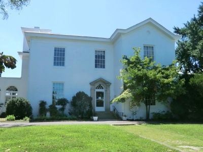
Photographed by Don Morfe, July 29, 2013
2. Bleak House
Credits. This page was last revised on January 20, 2020. It was originally submitted on October 19, 2013, by Don Morfe of Baltimore, Maryland. This page has been viewed 1,543 times since then and 82 times this year. Photos: 1, 2. submitted on October 19, 2013, by Don Morfe of Baltimore, Maryland. • Bernard Fisher was the editor who published this page.
